Frohnau geodata
Frohnau (Berlin) is a section of populated place; located in Germany in Europe/Berlin (GMT+2) time zone. With population of 16,571 people, there are 955 cities with bigger population in this country. Compared to other cities in Germany, 79.1% of cities are located further ↓South; 94.3% of cities are located further ←West and 77.3% of cities have higher elevation than Frohnau. Note1


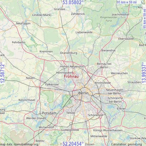
Frohnau GPS coordinates[2]
52° 38' 0.096" North, 13° 17' 24.864" East
| Map corner | latitude | longitude |
|---|---|---|
| Upper-left | 53.05802°, | 12.58712° |
| Center: | 52.63336°, | 13.29024° |
| Lower-right: | 52.20454°, | 13.99337° |
| Map W x H: | 94.9×94.9 km | = 59×59mi |
| max Lat: | 55.01917° ⇑20.9% North |
| Frohnau: | 52.63336° |
| min Lat: | ⇓79.1% South 47.40724° |
| min Long | Frohnau | max Long |
| 5.92978° | 13.29024° | 14.98853° |
| W 94.3%⇐ | ⇒5.7% E |
Elevation
Elevation of Frohnau is 55 m = 180 ft, and this is 194.1 m = 637 ft below average elevation for this country.
| Max E: |
1256 m = 4121 ft | 77.3% |
| Avg. | 249.1 m = 817 ft | |
| Frohnau | 55 m = 180 ft | |
Min E: |
-5 m = -16 ft | 22.7% |
See also: Germany elevation on elevation.city.
Geographical zone
Frohnau is located in North temperate zone (between Tropic of Cancer and the Arctic Circle). Distance of this North polar circle is 1548.9 km =962.4 mi to North.| Distance of | km | miles | from Frohnau |
|---|---|---|---|
| North Pole | 4154.8 | 2581.7 | to North |
| Arctic Circle | 1548.9 | 962.4 | to North |
| Tropic Cancer | 3246.4 | 2017.2 | to South |
| Equator | 5852.3 | 3636.4 | to South |


Nearby cities:
15 places around Frohnau: (largest is in red/bold)
• Birkenwerder
5.6 km =3.5 mi,  355°
355°
• Blankenfelde
7 km =4.3 mi,  103°
103°
• Glienicke
2.4 km =1.5 mi,  89°
89°
• Heiligensee
3.7 km =2.3 mi,  235°
235°
• Hennigsdorf
5.8 km =3.6 mi,  272°
272°
• Hermsdorf
2.4 km =1.5 mi,  153°
153°
• Hohen Neuendorf
4.8 km =3 mi,  349°
349°
• Konradshöhe
6.8 km =4.2 mi,  218°
218°
• Lübars
4.7 km =2.9 mi,  114°
114°
• Märkisches Viertel
6 km =3.7 mi,  130°
130°
• Rosenthal
7 km =4.3 mi,  122°
122°
• Tegel
6.4 km =4 mi,  177°
177°
• Waidmannslust
3.5 km =2.2 mi, 145°
• Wilhelmsruh
7.4 km =4.6 mi, 134°
• Wittenau
4.9 km =3 mi, 154°
Sources, notices
• [Note1] Compared only with cities in Germany existing in our database
• [Src1] Map data: © OpenStreetMap contributors (CC-BY-SA)
• [Src2] Other city data from geonames.org with taken over terms of usage.
• [Src3] Geographical zone / Annual Mean Temperature by Robert A. Rohde @ Wikipedia
