Birkenwerder geodata
Birkenwerder (Brandenburg) is a seat of a fourth-order administrative division; located in Germany in Europe/Berlin (GMT+2) time zone. With population of 7,122 people, there are 2155 cities with bigger population in this country. Compared to other cities in Germany, 79.5% of cities are located further ↓South; 94.2% of cities are located further ←West and 79.9% of cities have higher elevation than Birkenwerder. Note1


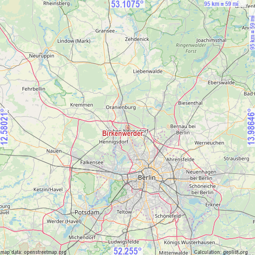
Birkenwerder GPS coordinates[2]
52° 40' 59.988" North, 13° 16' 59.988" East
| Map corner | latitude | longitude |
|---|---|---|
| Upper-left | 53.1075°, | 12.58021° |
| Center: | 52.68333°, | 13.28333° |
| Lower-right: | 52.255°, | 13.98646° |
| Map W x H: | 94.8×94.8 km | = 58.9×58.9mi |
| max Lat: | 55.01917° ⇑20.5% North |
| Birkenwerder: | 52.68333° |
| min Lat: | ⇓79.5% South 47.40724° |
| min Long | Birkenwerder | max Long |
| 5.92978° | 13.28333° | 14.98853° |
| W 94.2%⇐ | ⇒5.8% E |
Elevation
Elevation of Birkenwerder is 47 m = 154 ft, and this is 202.1 m = 663 ft below average elevation for this country.
| Max E: |
1256 m = 4121 ft | 79.9% |
| Avg. | 249.1 m = 817 ft | |
| Birkenwerder | 47 m = 154 ft | |
Min E: |
-5 m = -16 ft | 20.1% |
See also: Germany elevation on elevation.city.
Geographical zone
Birkenwerder is located in North temperate zone (between Tropic of Cancer and the Arctic Circle). Distance of this North polar circle is 1543.3 km =959 mi to North.| Distance of | km | miles | from Birkenwerder |
|---|---|---|---|
| North Pole | 4149.2 | 2578.2 | to North |
| Arctic Circle | 1543.3 | 959 | to North |
| Tropic Cancer | 3251.9 | 2020.6 | to South |
| Equator | 5857.8 | 3639.9 | to South |


Nearby cities:
15 places around Birkenwerder: (largest is in red/bold)
• Blankenfelde
10.2 km =6.3 mi,  134°
134°
• Frohnau
5.6 km =3.5 mi,  175°
175°
• Glienicke
6.2 km =3.9 mi,  152°
152°
• Heiligensee
8.1 km =5 mi,  198°
198°
• Hennigsdorf
7.5 km =4.7 mi,  225°
225°
• Hermsdorf
7.8 km =4.8 mi,  168°
168°
• Hohen Neuendorf
0.9 km =0.6 mi,  205°
205°
• Leegebruch
7.5 km =4.7 mi,  306°
306°
• Lübars
8.9 km =5.5 mi, 147°
• Märkisches Viertel
10.7 km =6.6 mi, 152°
• Oranienburg
8.5 km =5.3 mi,  340°
340°
• Rosenthal
11.3 km =7 mi, 145°
• Velten
7.3 km =4.5 mi,  277°
277°
• Waidmannslust
8.8 km =5.5 mi,  163°
163°
• Wittenau
10.3 km =6.4 mi, 165°
Sources, notices
• [Note1] Compared only with cities in Germany existing in our database
• [Src1] Map data: © OpenStreetMap contributors (CC-BY-SA)
• [Src2] Other city data from geonames.org with taken over terms of usage.
• [Src3] Geographical zone / Annual Mean Temperature by Robert A. Rohde @ Wikipedia
