Masserberg geodata
Masserberg (Thuringia) is a seat of a fourth-order administrative division; located in Germany in Europe/Berlin (GMT+2) time zone. With population of 2,828 people, there are 4148 cities with bigger population in this country. Compared to other cities in Germany, 52.3% of cities are located further ↑North; 66.6% of cities are located further ←West and 98.8% of cities have lower elevation than Masserberg. Note1
Administrative division(s):
- Level 1: Thuringia
- Level 3: Landkreis Hildburghausen
- Level 4: Masserberg


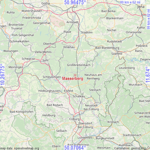
Masserberg GPS coordinates[2]
50° 31' 11.316" North, 10° 58' 15.132" East
| Map corner | latitude | longitude |
|---|---|---|
| Upper-left | 50.96475°, | 10.26775° |
| Center: | 50.51981°, | 10.97087° |
| Lower-right: | 50.07064°, | 11.674° |
| Map W x H: | 99.4×99.4 km | = 61.8×61.8mi |
| max Lat: | 55.01917° ⇑52.3% North |
| Masserberg: | 50.51981° |
| min Lat: | ⇓47.7% South 47.40724° |
| min Long | Masserberg | max Long |
| 5.92978° | 10.97087° | 14.98853° |
| W 66.6%⇐ | ⇒33.4% E |
Elevation
Elevation of Masserberg is 763 m = 2503 ft, and this is 513.9 m = 1686 ft above average elevation for this country.
| Max E: |
1256 m = 4121 ft | 1.2% |
| Masserberg | 763 m 2503 ft | |
| Avg. | 249.1 m = 817 ft | |
Min E: |
-5 m = -16 ft | 98.8% |
See also: Germany elevation on elevation.city.
Geographical zone
Masserberg is located in North temperate zone (between Tropic of Cancer and the Arctic Circle). Distance of this North polar circle is 1783.9 km =1108.5 mi to North.| Distance of | km | miles | from Masserberg |
|---|---|---|---|
| North Pole | 4389.8 | 2727.7 | to North |
| Arctic Circle | 1783.9 | 1108.5 | to North |
| Tropic Cancer | 3011.4 | 1871.2 | to South |
| Equator | 5617.3 | 3490.4 | to South |


Nearby cities:
15 places around Masserberg: (largest is in red/bold)
• Altenfeld
5.2 km =3.2 mi,  356°
356°
• Böhlen
9.2 km =5.7 mi,  34°
34°
• Eisfeld
11.3 km =7 mi,  203°
203°
• Frauenwald
10.7 km =6.6 mi,  312°
312°
• Friedersdorf
10.5 km =6.5 mi, 25°
• Gillersdorf
11.2 km =7 mi,  16°
16°
• Goldisthal
2.1 km =1.3 mi,  99°
99°
• Großbreitenbach
7.6 km =4.7 mi, 21°
• Katzhütte
6.8 km =4.2 mi,  58°
58°
• Meuselbach
10.3 km =6.4 mi, 55°
• Neustadt am Rennsteig
7.5 km =4.7 mi,  339°
339°
• Sachsenbrunn
8.2 km =5.1 mi,  190°
190°
• Scheibe-Alsbach
7.4 km =4.6 mi,  118°
118°
• Steinheid
10 km =6.2 mi,  127°
127°
• Wildenspring
11.2 km =7 mi,  37°
37°
Sources, notices
• [Note1] Compared only with cities in Germany existing in our database
• [Src1] Map data: © OpenStreetMap contributors (CC-BY-SA)
• [Src2] Other city data from geonames.org with taken over terms of usage.
• [Src3] Geographical zone / Annual Mean Temperature by Robert A. Rohde @ Wikipedia
