Ellingen geodata
Ellingen (Bavaria) is a populated place; located in Germany in Europe/Berlin (GMT+2) time zone. With population of 3,738 people, there are 3449 cities with bigger population in this country. Compared to other cities in Germany, 82.3% of cities are located further ↑North; 66.5% of cities are located further ←West and 74.9% of cities have lower elevation than Ellingen. Note1
Administrative division(s):
- Level 1: Bavaria
- Level 2: Regierungsbezirk Mittelfranken
- Level 3: Landkreis Weißenburg-Gunzenhausen
- Level 4: Ellingen


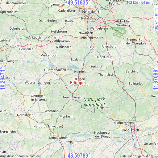
Ellingen GPS coordinates[2]
49° 3' 38.736" North, 10° 58' 4.188" East
| Map corner | latitude | longitude |
|---|---|---|
| Upper-left | 49.51935°, | 10.26471° |
| Center: | 49.06076°, | 10.96783° |
| Lower-right: | 48.59789°, | 11.67096° |
| Map W x H: | 102.5×102.5 km | = 63.7×63.7mi |
| max Lat: | 55.01917° ⇑82.3% North |
| Ellingen: | 49.06076° |
| min Lat: | ⇓17.7% South 47.40724° |
| min Long | Ellingen | max Long |
| 5.92978° | 10.96783° | 14.98853° |
| W 66.5%⇐ | ⇒33.5% E |
Elevation
Elevation of Ellingen is 397 m = 1302 ft, and this is 147.9 m = 485 ft above average elevation for this country.
| Max E: |
1256 m = 4121 ft | 25.1% |
| Ellingen | 397 m 1302 ft | |
| Avg. | 249.1 m = 817 ft | |
Min E: |
-5 m = -16 ft | 74.9% |
See also: Germany elevation on elevation.city.
Geographical zone
Ellingen is located in North temperate zone (between Tropic of Cancer and the Arctic Circle). Distance of this North polar circle is 1946.1 km =1209.3 mi to North.| Distance of | km | miles | from Ellingen |
|---|---|---|---|
| North Pole | 4552 | 2828.5 | to North |
| Arctic Circle | 1946.1 | 1209.3 | to North |
| Tropic Cancer | 2849.1 | 1770.3 | to South |
| Equator | 5455 | 3389.6 | to South |


Nearby cities:
15 places around Ellingen: (largest is in red/bold)
• Absberg
11.2 km =7 mi,  325°
325°
• Alesheim
7.7 km =4.8 mi,  258°
258°
• Bergen
10.7 km =6.6 mi,  82°
82°
• Burgsalach
9.9 km =6.2 mi,  107°
107°
• Ettenstatt
6.6 km =4.1 mi,  73°
73°
• Höttingen
2.7 km =1.7 mi,  85°
85°
• Markt Berolzheim
10.6 km =6.6 mi,  237°
237°
• Meinheim
11.4 km =7.1 mi,  254°
254°
• Nennslingen
12 km =7.5 mi,  97°
97°
• Pfofeld
10.8 km =6.7 mi,  297°
297°
• Pleinfeld
5 km =3.1 mi,  11°
11°
• Raitenbuch
12.5 km =7.8 mi, 114°
• Röttenbach
11 km =6.8 mi,  25°
25°
• Treuchtlingen
12.6 km =7.8 mi,  200°
200°
• Weißenburg in Bayern
3.3 km =2.1 mi,  174°
174°
Sources, notices
• [Note1] Compared only with cities in Germany existing in our database
• [Src1] Map data: © OpenStreetMap contributors (CC-BY-SA)
• [Src2] Other city data from geonames.org with taken over terms of usage.
• [Src3] Geographical zone / Annual Mean Temperature by Robert A. Rohde @ Wikipedia
