Raitenbuch geodata
Raitenbuch (Bavaria) is a seat of a fourth-order administrative division; located in Germany in Europe/Berlin (GMT+2) time zone. With population of 1,176 people, there are 6632 cities with bigger population in this country. Compared to other cities in Germany, 82.9% of cities are located further ↑North; 68.7% of cities are located further ←West and 93.2% of cities have lower elevation than Raitenbuch. Note1
Administrative division(s):
- Level 1: Bavaria
- Level 2: Regierungsbezirk Mittelfranken
- Level 3: Landkreis Weißenburg-Gunzenhausen
- Level 4: Raitenbuch


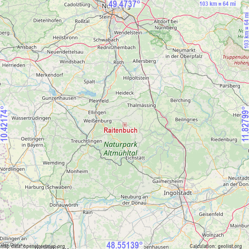
Raitenbuch GPS coordinates[2]
49° 0' 52.848" North, 11° 7' 29.496" East
| Map corner | latitude | longitude |
|---|---|---|
| Upper-left | 49.4737°, | 10.42174° |
| Center: | 49.01468°, | 11.12486° |
| Lower-right: | 48.55139°, | 11.82799° |
| Map W x H: | 102.6×102.5 km | = 63.8×63.7mi |
| max Lat: | 55.01917° ⇑82.9% North |
| Raitenbuch: | 49.01468° |
| min Lat: | ⇓17.1% South 47.40724° |
| min Long | Raitenbuch | max Long |
| 5.92978° | 11.12486° | 14.98853° |
| W 68.7%⇐ | ⇒31.3% E |
Elevation
Elevation of Raitenbuch is 561 m = 1841 ft, and this is 311.9 m = 1023 ft above average elevation for this country.
| Max E: |
1256 m = 4121 ft | 6.8% |
| Raitenbuch | 561 m 1841 ft | |
| Avg. | 249.1 m = 817 ft | |
Min E: |
-5 m = -16 ft | 93.2% |
See also: Germany elevation on elevation.city.
Geographical zone
Raitenbuch is located in North temperate zone (between Tropic of Cancer and the Arctic Circle). Distance of this North polar circle is 1951.3 km =1212.5 mi to North.| Distance of | km | miles | from Raitenbuch |
|---|---|---|---|
| North Pole | 4557.1 | 2831.6 | to North |
| Arctic Circle | 1951.3 | 1212.5 | to North |
| Tropic Cancer | 2844 | 1767.2 | to South |
| Equator | 5449.9 | 3386.4 | to South |


Nearby cities:
15 places around Raitenbuch: (largest is in red/bold)
• Bergen
6.6 km =4.1 mi,  353°
353°
• Burgsalach
2.9 km =1.8 mi,  316°
316°
• Eichstätt
15 km =9.3 mi,  159°
159°
• Ellingen
12.5 km =7.8 mi,  294°
294°
• Ettenstatt
8.6 km =5.3 mi, 324°
• Heideck
13.2 km =8.2 mi,  0°
0°
• Höttingen
10.2 km =6.3 mi,  301°
301°
• Nennslingen
3.6 km =2.2 mi,  6°
6°
• Pappenheim
14.2 km =8.8 mi,  230°
230°
• Pleinfeld
14.4 km =8.9 mi,  313°
313°
• Pollenfeld
9 km =5.6 mi,  142°
142°
• Schernfeld
12.9 km =8 mi,  188°
188°
• Solnhofen
16.2 km =10.1 mi,  215°
215°
• Thalmässing
10.8 km =6.7 mi,  40°
40°
• Weißenburg in Bayern
11.3 km =7 mi,  279°
279°
Sources, notices
• [Note1] Compared only with cities in Germany existing in our database
• [Src1] Map data: © OpenStreetMap contributors (CC-BY-SA)
• [Src2] Other city data from geonames.org with taken over terms of usage.
• [Src3] Geographical zone / Annual Mean Temperature by Robert A. Rohde @ Wikipedia
