Nennslingen geodata
Nennslingen (Bavaria) is a populated place; located in Germany in Europe/Berlin (GMT+2) time zone. With population of 1,465 people, there are 5948 cities with bigger population in this country. Compared to other cities in Germany, 82.4% of cities are located further ↑North; 68.8% of cities are located further ←West and 90.8% of cities have lower elevation than Nennslingen. Note1
Administrative division(s):
- Level 1: Bavaria
- Level 2: Regierungsbezirk Mittelfranken
- Level 3: Landkreis Weißenburg-Gunzenhausen
- Level 4: Nennslingen, Markt


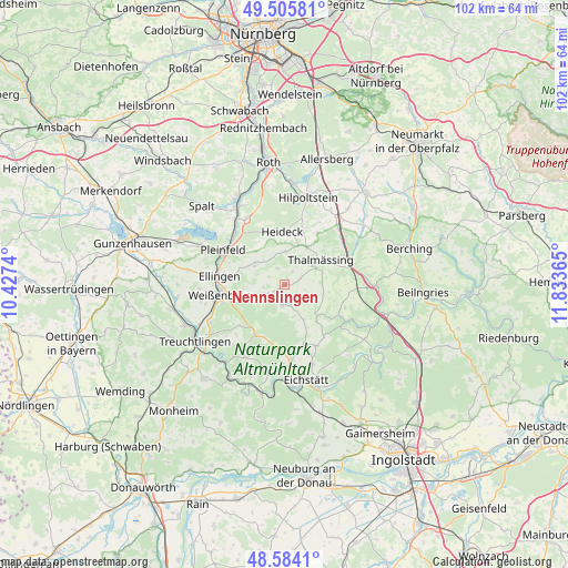
Nennslingen GPS coordinates[2]
49° 2' 49.524" North, 11° 7' 49.872" East
| Map corner | latitude | longitude |
|---|---|---|
| Upper-left | 49.50581°, | 10.4274° |
| Center: | 49.04709°, | 11.13052° |
| Lower-right: | 48.5841°, | 11.83365° |
| Map W x H: | 102.5×102.5 km | = 63.7×63.7mi |
| max Lat: | 55.01917° ⇑82.4% North |
| Nennslingen: | 49.04709° |
| min Lat: | ⇓17.6% South 47.40724° |
| min Long | Nennslingen | max Long |
| 5.92978° | 11.13052° | 14.98853° |
| W 68.8%⇐ | ⇒31.2% E |
Elevation
Elevation of Nennslingen is 524 m = 1719 ft, and this is 274.9 m = 902 ft above average elevation for this country.
| Max E: |
1256 m = 4121 ft | 9.2% |
| Nennslingen | 524 m 1719 ft | |
| Avg. | 249.1 m = 817 ft | |
Min E: |
-5 m = -16 ft | 90.8% |
See also: Germany elevation on elevation.city.
Geographical zone
Nennslingen is located in North temperate zone (between Tropic of Cancer and the Arctic Circle). Distance of this North polar circle is 1947.6 km =1210.2 mi to North.| Distance of | km | miles | from Nennslingen |
|---|---|---|---|
| North Pole | 4553.5 | 2829.4 | to North |
| Arctic Circle | 1947.6 | 1210.2 | to North |
| Tropic Cancer | 2847.6 | 1769.4 | to South |
| Equator | 5453.5 | 3388.6 | to South |


Nearby cities:
15 places around Nennslingen: (largest is in red/bold)
• Bergen
3.2 km =2 mi,  337°
337°
• Burgsalach
2.9 km =1.8 mi,  237°
237°
• Ellingen
12 km =7.5 mi,  277°
277°
• Ettenstatt
6.4 km =4 mi,  301°
301°
• Greding
16.5 km =10.3 mi,  90°
90°
• Heideck
9.6 km =6 mi,  358°
358°
• Hilpoltstein
16.5 km =10.3 mi,  15°
15°
• Höttingen
9.3 km =5.8 mi, 280°
• Pleinfeld
12.6 km =7.8 mi, 300°
• Pollenfeld
11.9 km =7.4 mi,  154°
154°
• Raitenbuch
3.6 km =2.2 mi,  186°
186°
• Röttenbach
13.5 km =8.4 mi,  328°
328°
• Schernfeld
16.5 km =10.3 mi, 187°
• Thalmässing
8.1 km =5 mi,  55°
55°
• Weißenburg in Bayern
11.7 km =7.3 mi,  261°
261°
Sources, notices
• [Note1] Compared only with cities in Germany existing in our database
• [Src1] Map data: © OpenStreetMap contributors (CC-BY-SA)
• [Src2] Other city data from geonames.org with taken over terms of usage.
• [Src3] Geographical zone / Annual Mean Temperature by Robert A. Rohde @ Wikipedia
