Egweil geodata
Egweil (Bavaria) is a seat of a fourth-order administrative division; located in Germany in Europe/Berlin (GMT+2) time zone. In our database, there are 11009 cities with bigger population. Compared to other cities in Germany, 85.5% of cities are located further ↑North; 70.4% of cities are located further ←West and 74.2% of cities have lower elevation than Egweil. Note1
Administrative division(s):
- Level 1: Bavaria
- Level 2: Upper Bavaria
- Level 3: Landkreis Eichstätt
- Level 4: Egweil


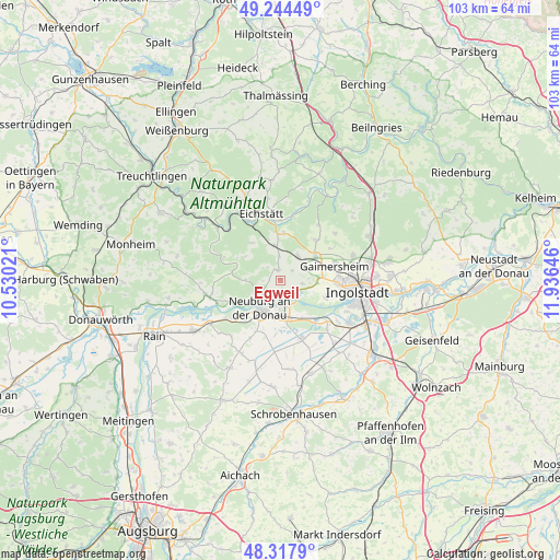
Egweil GPS coordinates[2]
48° 46' 59.988" North, 11° 13' 59.988" East
| Map corner | latitude | longitude |
|---|---|---|
| Upper-left | 49.24449°, | 10.53021° |
| Center: | 48.78333°, | 11.23333° |
| Lower-right: | 48.3179°, | 11.93646° |
| Map W x H: | 103×103 km | = 64×64mi |
| max Lat: | 55.01917° ⇑85.5% North |
| Egweil: | 48.78333° |
| min Lat: | ⇓14.5% South 47.40724° |
| min Long | Egweil | max Long |
| 5.92978° | 11.23333° | 14.98853° |
| W 70.4%⇐ | ⇒29.6% E |
Elevation
Elevation of Egweil is 391 m = 1283 ft, and this is 141.9 m = 466 ft above average elevation for this country.
| Max E: |
1256 m = 4121 ft | 25.8% |
| Egweil | 391 m 1283 ft | |
| Avg. | 249.1 m = 817 ft | |
Min E: |
-5 m = -16 ft | 74.2% |
See also: Germany elevation on elevation.city.
Geographical zone
Egweil is located in North temperate zone (between Tropic of Cancer and the Arctic Circle). Distance of this North polar circle is 1977 km =1228.5 mi to North.| Distance of | km | miles | from Egweil |
|---|---|---|---|
| North Pole | 4582.9 | 2847.7 | to North |
| Arctic Circle | 1977 | 1228.5 | to North |
| Tropic Cancer | 2818.3 | 1751.2 | to South |
| Equator | 5424.2 | 3370.4 | to South |


Nearby cities:
15 places around Egweil: (largest is in red/bold)
• Adelschlag
6.4 km =4 mi,  350°
350°
• Bergheim
3.1 km =1.9 mi,  145°
145°
• Buxheim
5 km =3.1 mi,  58°
58°
• Böhmfeld
13.1 km =8.1 mi,  48°
48°
• Eichstätt
12 km =7.5 mi, 347°
• Eitensheim
7.1 km =4.4 mi, 58°
• Gaimersheim
10.2 km =6.3 mi,  75°
75°
• Hitzhofen
9.6 km =6 mi,  39°
39°
• Karlshuld
11.9 km =7.4 mi,  161°
161°
• Neuburg an der Donau
6.6 km =4.1 mi,  210°
210°
• Oberhausen
11.2 km =7 mi,  232°
232°
• Rennertshofen
14 km =8.7 mi,  259°
259°
• Rohrenfels
12.2 km =7.6 mi, 207°
• Weichering
9.8 km =6.1 mi,  138°
138°
• Wettstetten
13.9 km =8.6 mi,  71°
71°
Sources, notices
• [Note1] Compared only with cities in Germany existing in our database
• [Src1] Map data: © OpenStreetMap contributors (CC-BY-SA)
• [Src2] Other city data from geonames.org with taken over terms of usage.
• [Src3] Geographical zone / Annual Mean Temperature by Robert A. Rohde @ Wikipedia
