Rohrenfels geodata
Rohrenfels (Bavaria) is a seat of a fourth-order administrative division; located in Germany in Europe/Berlin (GMT+2) time zone. With population of 1,489 people, there are 5904 cities with bigger population in this country. Compared to other cities in Germany, 86.6% of cities are located further ↑North; 69.3% of cities are located further ←West and 74.3% of cities have lower elevation than Rohrenfels. Note1
Administrative division(s):
- Level 1: Bavaria
- Level 2: Upper Bavaria
- Level 3: Landkreis Neuburg-Schrobenhausen
- Level 4: Rohrenfels


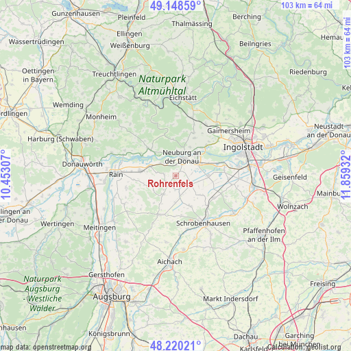
Rohrenfels GPS coordinates[2]
48° 41' 11.544" North, 11° 9' 22.284" East
| Map corner | latitude | longitude |
|---|---|---|
| Upper-left | 49.14859°, | 10.45307° |
| Center: | 48.68654°, | 11.15619° |
| Lower-right: | 48.22021°, | 11.85932° |
| Map W x H: | 103.2×103.2 km | = 64.1×64.1mi |
| max Lat: | 55.01917° ⇑86.6% North |
| Rohrenfels: | 48.68654° |
| min Lat: | ⇓13.4% South 47.40724° |
| min Long | Rohrenfels | max Long |
| 5.92978° | 11.15619° | 14.98853° |
| W 69.3%⇐ | ⇒30.7% E |
Elevation
Elevation of Rohrenfels is 392 m = 1286 ft, and this is 142.9 m = 469 ft above average elevation for this country.
| Max E: |
1256 m = 4121 ft | 25.7% |
| Rohrenfels | 392 m 1286 ft | |
| Avg. | 249.1 m = 817 ft | |
Min E: |
-5 m = -16 ft | 74.3% |
See also: Germany elevation on elevation.city.
Geographical zone
Rohrenfels is located in North temperate zone (between Tropic of Cancer and the Arctic Circle). Distance of this North polar circle is 1987.7 km =1235.1 mi to North.| Distance of | km | miles | from Rohrenfels |
|---|---|---|---|
| North Pole | 4593.6 | 2854.3 | to North |
| Arctic Circle | 1987.7 | 1235.1 | to North |
| Tropic Cancer | 2807.5 | 1744.5 | to South |
| Equator | 5413.4 | 3363.7 | to South |


Nearby cities:
15 places around Rohrenfels: (largest is in red/bold)
• Berg im Gau
9.1 km =5.7 mi,  130°
130°
• Bergheim
11.1 km =6.9 mi,  42°
42°
• Brunnen
12.9 km =8 mi,  119°
119°
• Burgheim
10.4 km =6.5 mi,  278°
278°
• Buxheim
16.7 km =10.4 mi, 36°
• Egweil
12.2 km =7.6 mi,  27°
27°
• Ehekirchen
7.2 km =4.5 mi,  214°
214°
• Karlshuld
9.5 km =5.9 mi,  93°
93°
• Langenmosen
9.8 km =6.1 mi,  154°
154°
• Neuburg an der Donau
5.6 km =3.5 mi,  24°
24°
• Oberhausen
5.1 km =3.2 mi,  320°
320°
• Pöttmes
12.5 km =7.8 mi,  203°
203°
• Rennertshofen
11.5 km =7.1 mi,  314°
314°
• Schrobenhausen
16 km =9.9 mi, 151°
• Weichering
12.6 km =7.8 mi,  74°
74°
Sources, notices
• [Note1] Compared only with cities in Germany existing in our database
• [Src1] Map data: © OpenStreetMap contributors (CC-BY-SA)
• [Src2] Other city data from geonames.org with taken over terms of usage.
• [Src3] Geographical zone / Annual Mean Temperature by Robert A. Rohde @ Wikipedia
