Dürrröhrsdorf geodata
Dürrröhrsdorf (Saxony) is a populated place; located in Germany in Europe/Berlin (GMT+2) time zone. With population of 4,829 people, there are 2888 cities with bigger population in this country. Compared to other cities in Germany, 58.7% of cities are located further ↓South; 97.9% of cities are located further ←West and 50.3% of cities have higher elevation than Dürrröhrsdorf. Note1
Administrative division(s):
- Level 1: Saxony
- Level 3: Landkreis Sächsische Schweiz
- Level 4: Dürrröhrsdorf-Dittersbach


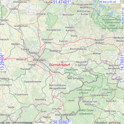
Dürrröhrsdorf GPS coordinates[2]
51° 2' 2.22" North, 13° 59' 49.848" East
| Map corner | latitude | longitude |
|---|---|---|
| Upper-left | 51.47401°, | 13.29406° |
| Center: | 51.03395°, | 13.99718° |
| Lower-right: | 50.58967°, | 14.70031° |
| Map W x H: | 98.3×98.3 km | = 61.1×61.1mi |
| max Lat: | 55.01917° ⇑41.3% North |
| Dürrröhrsdorf: | 51.03395° |
| min Lat: | ⇓58.7% South 47.40724° |
| min Long | Dürrröhrsdorf | max Long |
| 5.92978° | 13.99718° | 14.98853° |
| W 97.9%⇐ | ⇒2.1% E |
Elevation
Elevation of Dürrröhrsdorf is 223 m = 732 ft, and this is 26.1 m = 86 ft below average elevation for this country.
| Max E: |
1256 m = 4121 ft | 50.3% |
| Avg. | 249.1 m = 817 ft | |
| Dürrröhrsdorf | 223 m = 732 ft | |
Min E: |
-5 m = -16 ft | 49.7% |
See also: Germany elevation on elevation.city.
Geographical zone
Dürrröhrsdorf is located in North temperate zone (between Tropic of Cancer and the Arctic Circle). Distance of this North polar circle is 1726.7 km =1072.9 mi to North.| Distance of | km | miles | from Dürrröhrsdorf |
|---|---|---|---|
| North Pole | 4332.6 | 2692.2 | to North |
| Arctic Circle | 1726.7 | 1072.9 | to North |
| Tropic Cancer | 3068.5 | 1906.7 | to South |
| Equator | 5674.4 | 3525.9 | to South |


Nearby cities:
15 places around Dürrröhrsdorf: (largest is in red/bold)
• Arnsdorf
6.7 km =4.2 mi,  356°
356°
• Dohna
13 km =8.1 mi,  228°
228°
• Feldschlößchen
13 km =8.1 mi,  334°
334°
• Frankenthal
13.3 km =8.3 mi,  35°
35°
• Großharthau
10.8 km =6.7 mi, 41°
• Großröhrsdorf
12.5 km =7.8 mi,  7°
7°
• Heidenau
11.4 km =7.1 mi, 232°
• Hohnstein
10.1 km =6.3 mi,  126°
126°
• Lohmen
5.1 km =3.2 mi,  175°
175°
• Pirna
9.4 km =5.8 mi,  206°
206°
• Porschdorf
13.7 km =8.5 mi,  138°
138°
• Radeberg
10.4 km =6.5 mi, 325°
• Stadt Wehlen
8.7 km =5.4 mi,  164°
164°
• Stolpen
6 km =3.7 mi,  73°
73°
• Struppen
11.3 km =7 mi,  173°
173°
Sources, notices
• [Note1] Compared only with cities in Germany existing in our database
• [Src1] Map data: © OpenStreetMap contributors (CC-BY-SA)
• [Src2] Other city data from geonames.org with taken over terms of usage.
• [Src3] Geographical zone / Annual Mean Temperature by Robert A. Rohde @ Wikipedia
