Hohnstein geodata
Hohnstein (Saxony) is a populated place; located in Germany in Europe/Berlin (GMT+2) time zone. With population of 3,806 people, there are 3401 cities with bigger population in this country. Compared to other cities in Germany, 57.8% of cities are located further ↓South; 98.4% of cities are located further ←West and 64.3% of cities have lower elevation than Hohnstein. Note1
Administrative division(s):
- Level 1: Saxony
- Level 3: Landkreis Sächsische Schweiz
- Level 4: Hohnstein


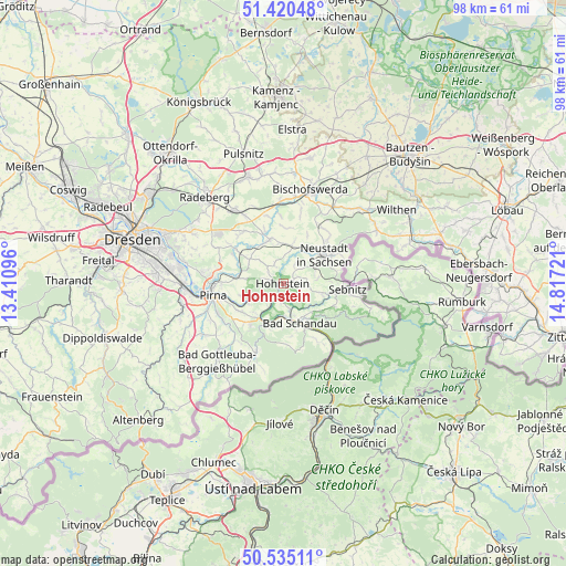
Hohnstein GPS coordinates[2]
50° 58' 47.676" North, 14° 6' 50.688" East
| Map corner | latitude | longitude |
|---|---|---|
| Upper-left | 51.42048°, | 13.41096° |
| Center: | 50.97991°, | 14.11408° |
| Lower-right: | 50.53511°, | 14.81721° |
| Map W x H: | 98.4×98.4 km | = 61.1×61.1mi |
| max Lat: | 55.01917° ⇑42.2% North |
| Hohnstein: | 50.97991° |
| min Lat: | ⇓57.8% South 47.40724° |
| min Long | Hohnstein | max Long |
| 5.92978° | 14.11408° | 14.98853° |
| W 98.4%⇐ | ⇒1.6% E |
Elevation
Elevation of Hohnstein is 317 m = 1040 ft, and this is 67.9 m = 223 ft above average elevation for this country.
| Max E: |
1256 m = 4121 ft | 35.7% |
| Hohnstein | 317 m 1040 ft | |
| Avg. | 249.1 m = 817 ft | |
Min E: |
-5 m = -16 ft | 64.3% |
See also: Germany elevation on elevation.city.
Geographical zone
Hohnstein is located in North temperate zone (between Tropic of Cancer and the Arctic Circle). Distance of this North polar circle is 1732.7 km =1076.6 mi to North.| Distance of | km | miles | from Hohnstein |
|---|---|---|---|
| North Pole | 4338.6 | 2695.9 | to North |
| Arctic Circle | 1732.7 | 1076.6 | to North |
| Tropic Cancer | 3062.5 | 1902.9 | to South |
| Equator | 5668.4 | 3522.2 | to South |


Nearby cities:
15 places around Hohnstein: (largest is in red/bold)
• Bad Schandau
7.5 km =4.7 mi,  157°
157°
• Berthelsdorf
10.6 km =6.6 mi,  45°
45°
• Dürrröhrsdorf
10.1 km =6.3 mi,  306°
306°
• Großharthau
14.2 km =8.8 mi,  355°
355°
• Kurort Gohrisch
7.5 km =4.7 mi,  183°
183°
• Königstein
7.7 km =4.8 mi,  202°
202°
• Lohmen
7.9 km =4.9 mi,  276°
276°
• Neustadt in Sachsen
9 km =5.6 mi, 53°
• Pirna
12.6 km =7.8 mi,  259°
259°
• Porschdorf
4.3 km =2.7 mi,  168°
168°
• Rathmannsdorf
5.9 km =3.7 mi, 160°
• Sebnitz
11.3 km =7 mi,  92°
92°
• Stadt Wehlen
6.3 km =3.9 mi,  247°
247°
• Stolpen
8.1 km =5 mi,  342°
342°
• Struppen
8.6 km =5.3 mi,  232°
232°
Sources, notices
• [Note1] Compared only with cities in Germany existing in our database
• [Src1] Map data: © OpenStreetMap contributors (CC-BY-SA)
• [Src2] Other city data from geonames.org with taken over terms of usage.
• [Src3] Geographical zone / Annual Mean Temperature by Robert A. Rohde @ Wikipedia
