Buhla geodata
Buhla (Thuringia) is a seat of a fourth-order administrative division; located in Germany in Europe/Berlin (GMT+2) time zone. With population of 617 people, there are 8732 cities with bigger population in this country. Compared to other cities in Germany, 65.3% of cities are located further ↓South; 57.7% of cities are located further ←West and 78.5% of cities have lower elevation than Buhla. Note1


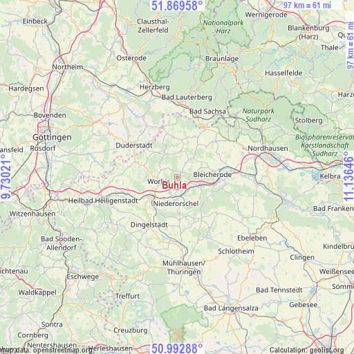
Buhla GPS coordinates[2]
51° 25' 59.988" North, 10° 25' 59.988" East
| Map corner | latitude | longitude |
|---|---|---|
| Upper-left | 51.86958°, | 9.73021° |
| Center: | 51.43333°, | 10.43333° |
| Lower-right: | 50.99288°, | 11.13646° |
| Map W x H: | 97.5×97.5 km | = 60.6×60.6mi |
| max Lat: | 55.01917° ⇑34.7% North |
| Buhla: | 51.43333° |
| min Lat: | ⇓65.3% South 47.40724° |
| min Long | Buhla | max Long |
| 5.92978° | 10.43333° | 14.98853° |
| W 57.7%⇐ | ⇒42.3% E |
Elevation
Elevation of Buhla is 423 m = 1388 ft, and this is 173.9 m = 571 ft above average elevation for this country.
| Max E: |
1256 m = 4121 ft | 21.5% |
| Buhla | 423 m 1388 ft | |
| Avg. | 249.1 m = 817 ft | |
Min E: |
-5 m = -16 ft | 78.5% |
See also: Germany elevation on elevation.city.
Geographical zone
Buhla is located in North temperate zone (between Tropic of Cancer and the Arctic Circle). Distance of this North polar circle is 1682.3 km =1045.3 mi to North.| Distance of | km | miles | from Buhla |
|---|---|---|---|
| North Pole | 4288.2 | 2664.6 | to North |
| Arctic Circle | 1682.3 | 1045.3 | to North |
| Tropic Cancer | 3112.9 | 1934.3 | to South |
| Equator | 5718.9 | 3553.6 | to South |


Nearby cities:
15 places around Buhla: (largest is in red/bold)
• Bischofferode
7.1 km =4.4 mi,  5°
5°
• Breitenworbis
2.3 km =1.4 mi,  188°
188°
• Gernrode
4.4 km =2.7 mi,  211°
211°
• Gerterode
6.6 km =4.1 mi,  148°
148°
• Großbodungen
5.8 km =3.6 mi,  35°
35°
• Hausen
7.2 km =4.5 mi,  219°
219°
• Haynrode
1.6 km =1 mi,  31°
31°
• Holungen
7 km =4.3 mi,  336°
336°
• Kirchworbis
3.6 km =2.2 mi,  226°
226°
• Kraja
6.1 km =3.8 mi,  72°
72°
• Neustadt
4.4 km =2.7 mi, 31°
• Niederorschel
6.8 km =4.2 mi, 185°
• Sollstedt
7.2 km =4.5 mi,  104°
104°
• Wintzingerode
6.9 km =4.3 mi,  279°
279°
• Worbis
5.1 km =3.2 mi,  252°
252°
Sources, notices
• [Note1] Compared only with cities in Germany existing in our database
• [Src1] Map data: © OpenStreetMap contributors (CC-BY-SA)
• [Src2] Other city data from geonames.org with taken over terms of usage.
• [Src3] Geographical zone / Annual Mean Temperature by Robert A. Rohde @ Wikipedia
