Breitenthal geodata
Breitenthal (Bavaria) is a seat of a fourth-order administrative division; located in Germany in Europe/Berlin (GMT+2) time zone. With population of 1,293 people, there are 6327 cities with bigger population in this country. Compared to other cities in Germany, 92.1% of cities are located further ↑North; 55.3% of cities are located further ←West and 90.4% of cities have lower elevation than Breitenthal. Note1
Administrative division(s):
- Level 1: Bavaria
- Level 2: Swabia
- Level 3: Landkreis Günzburg
- Level 4: Breitenthal


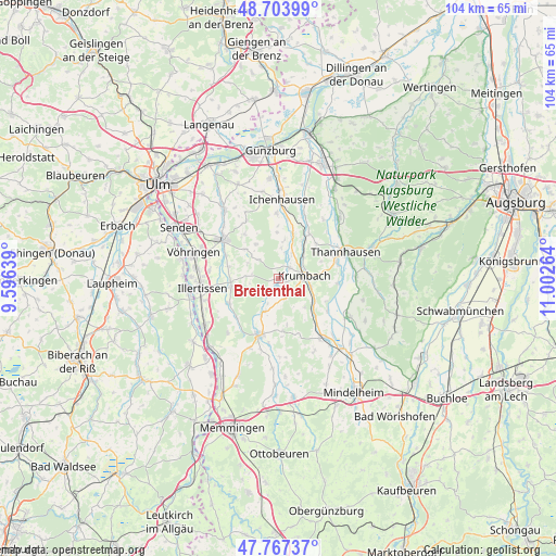
Breitenthal GPS coordinates[2]
48° 14' 16.152" North, 10° 17' 58.236" East
| Map corner | latitude | longitude |
|---|---|---|
| Upper-left | 48.70399°, | 9.59639° |
| Center: | 48.23782°, | 10.29951° |
| Lower-right: | 47.76737°, | 11.00264° |
| Map W x H: | 104.1×104.1 km | = 64.7×64.7mi |
| max Lat: | 55.01917° ⇑92.1% North |
| Breitenthal: | 48.23782° |
| min Lat: | ⇓7.9% South 47.40724° |
| min Long | Breitenthal | max Long |
| 5.92978° | 10.29951° | 14.98853° |
| W 55.3%⇐ | ⇒44.7% E |
Elevation
Elevation of Breitenthal is 519 m = 1703 ft, and this is 269.9 m = 885 ft above average elevation for this country.
| Max E: |
1256 m = 4121 ft | 9.6% |
| Breitenthal | 519 m 1703 ft | |
| Avg. | 249.1 m = 817 ft | |
Min E: |
-5 m = -16 ft | 90.4% |
See also: Germany elevation on elevation.city.
Geographical zone
Breitenthal is located in North temperate zone (between Tropic of Cancer and the Arctic Circle). Distance of this North polar circle is 2037.6 km =1266.1 mi to North.| Distance of | km | miles | from Breitenthal |
|---|---|---|---|
| North Pole | 4643.5 | 2885.3 | to North |
| Arctic Circle | 2037.6 | 1266.1 | to North |
| Tropic Cancer | 2757.6 | 1713.5 | to South |
| Equator | 5363.5 | 3332.7 | to South |


Nearby cities:
15 places around Breitenthal: (largest is in red/bold)
• Aletshausen
7.9 km =4.9 mi,  123°
123°
• Babenhausen
10.9 km =6.8 mi,  198°
198°
• Bayersried
11.3 km =7 mi,  77°
77°
• Buch
8.9 km =5.5 mi,  260°
260°
• Deisenhausen
2.8 km =1.7 mi,  45°
45°
• Ebershausen
3.8 km =2.4 mi,  161°
161°
• Ellzee
11.4 km =7.1 mi,  7°
7°
• Kettershausen
6.5 km =4 mi, 201°
• Kirchhaslach
9.8 km =6.1 mi,  175°
175°
• Krumbach
4.7 km =2.9 mi, 84°
• Oberroth
10.7 km =6.6 mi,  229°
229°
• Roggenburg
6.6 km =4.1 mi,  309°
309°
• Unterroth
10.6 km =6.6 mi,  243°
243°
• Ursberg
11.2 km =7 mi,  74°
74°
• Waltenhausen
7.1 km =4.4 mi,  137°
137°
Sources, notices
• [Note1] Compared only with cities in Germany existing in our database
• [Src1] Map data: © OpenStreetMap contributors (CC-BY-SA)
• [Src2] Other city data from geonames.org with taken over terms of usage.
• [Src3] Geographical zone / Annual Mean Temperature by Robert A. Rohde @ Wikipedia
