Unterroth geodata
Unterroth (Bavaria) is a seat of a fourth-order administrative division; located in Germany in Europe/Berlin (GMT+2) time zone. With population of 951 people, there are 7345 cities with bigger population in this country. Compared to other cities in Germany, 92.7% of cities are located further ↑North; 52.9% of cities are located further ←West and 90.8% of cities have lower elevation than Unterroth. Note1
Administrative division(s):
- Level 1: Bavaria
- Level 2: Swabia
- Level 3: Landkreis Neu-Ulm
- Level 4: Unterroth


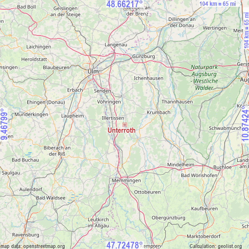
Unterroth GPS coordinates[2]
48° 11' 44.232" North, 10° 10' 15.996" East
| Map corner | latitude | longitude |
|---|---|---|
| Upper-left | 48.66217°, | 9.46799° |
| Center: | 48.19562°, | 10.17111° |
| Lower-right: | 47.72478°, | 10.87424° |
| Map W x H: | 104.2×104.2 km | = 64.7×64.7mi |
| max Lat: | 55.01917° ⇑92.7% North |
| Unterroth: | 48.19562° |
| min Lat: | ⇓7.3% South 47.40724° |
| min Long | Unterroth | max Long |
| 5.92978° | 10.17111° | 14.98853° |
| W 52.9%⇐ | ⇒47.1% E |
Elevation
Elevation of Unterroth is 525 m = 1722 ft, and this is 275.9 m = 905 ft above average elevation for this country.
| Max E: |
1256 m = 4121 ft | 9.2% |
| Unterroth | 525 m 1722 ft | |
| Avg. | 249.1 m = 817 ft | |
Min E: |
-5 m = -16 ft | 90.8% |
See also: Germany elevation on elevation.city.
Geographical zone
Unterroth is located in North temperate zone (between Tropic of Cancer and the Arctic Circle). Distance of this North polar circle is 2042.3 km =1269 mi to North.| Distance of | km | miles | from Unterroth |
|---|---|---|---|
| North Pole | 4648.2 | 2888.3 | to North |
| Arctic Circle | 2042.3 | 1269 | to North |
| Tropic Cancer | 2752.9 | 1710.6 | to South |
| Equator | 5358.9 | 3329.9 | to South |


Nearby cities:
15 places around Unterroth: (largest is in red/bold)
• Altenstadt
5.8 km =3.6 mi,  226°
226°
• Babenhausen
8.3 km =5.2 mi,  132°
132°
• Bellenberg
9.1 km =5.7 mi,  319°
319°
• Breitenthal
10.6 km =6.6 mi,  63°
63°
• Buch
3.3 km =2.1 mi,  12°
12°
• Dietenheim
7.6 km =4.7 mi,  282°
282°
• Ebershausen
10.8 km =6.7 mi,  84°
84°
• Illertissen
5.9 km =3.7 mi,  301°
301°
• Kellmünz
8.8 km =5.5 mi,  201°
201°
• Kettershausen
7.2 km =4.5 mi,  100°
100°
• Kirchberg an der Iller
9.5 km =5.9 mi,  223°
223°
• Oberroth
2.6 km =1.6 mi,  148°
148°
• Osterberg
5.1 km =3.2 mi,  183°
183°
• Roggenburg
10 km =6.2 mi,  26°
26°
• Winterrieden
9.2 km =5.7 mi, 153°
Sources, notices
• [Note1] Compared only with cities in Germany existing in our database
• [Src1] Map data: © OpenStreetMap contributors (CC-BY-SA)
• [Src2] Other city data from geonames.org with taken over terms of usage.
• [Src3] Geographical zone / Annual Mean Temperature by Robert A. Rohde @ Wikipedia
