Ebershausen geodata
Ebershausen (Bavaria) is a seat of a fourth-order administrative division; located in Germany in Europe/Berlin (GMT+2) time zone. With population of 618 people, there are 8730 cities with bigger population in this country. Compared to other cities in Germany, 92.6% of cities are located further ↑North; 55.7% of cities are located further ←West and 90.2% of cities have lower elevation than Ebershausen. Note1
Administrative division(s):
- Level 1: Bavaria
- Level 2: Swabia
- Level 3: Landkreis Günzburg
- Level 4: Ebershausen


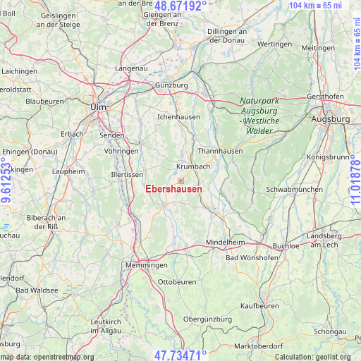
Ebershausen GPS coordinates[2]
48° 12' 19.656" North, 10° 18' 56.34" East
| Map corner | latitude | longitude |
|---|---|---|
| Upper-left | 48.67192°, | 9.61253° |
| Center: | 48.20546°, | 10.31565° |
| Lower-right: | 47.73471°, | 11.01878° |
| Map W x H: | 104.2×104.2 km | = 64.7×64.7mi |
| max Lat: | 55.01917° ⇑92.6% North |
| Ebershausen: | 48.20546° |
| min Lat: | ⇓7.4% South 47.40724° |
| min Long | Ebershausen | max Long |
| 5.92978° | 10.31565° | 14.98853° |
| W 55.7%⇐ | ⇒44.3% E |
Elevation
Elevation of Ebershausen is 517 m = 1696 ft, and this is 267.9 m = 879 ft above average elevation for this country.
| Max E: |
1256 m = 4121 ft | 9.8% |
| Ebershausen | 517 m 1696 ft | |
| Avg. | 249.1 m = 817 ft | |
Min E: |
-5 m = -16 ft | 90.2% |
See also: Germany elevation on elevation.city.
Geographical zone
Ebershausen is located in North temperate zone (between Tropic of Cancer and the Arctic Circle). Distance of this North polar circle is 2041.2 km =1268.3 mi to North.| Distance of | km | miles | from Ebershausen |
|---|---|---|---|
| North Pole | 4647.1 | 2887.6 | to North |
| Arctic Circle | 2041.2 | 1268.3 | to North |
| Tropic Cancer | 2754 | 1711.3 | to South |
| Equator | 5359.9 | 3330.5 | to South |


Nearby cities:
15 places around Ebershausen: (largest is in red/bold)
• Aletshausen
5.5 km =3.4 mi,  98°
98°
• Babenhausen
8.2 km =5.1 mi,  214°
214°
• Breitenbrunn
10.2 km =6.3 mi,  142°
142°
• Breitenthal
3.8 km =2.4 mi,  341°
341°
• Buch
10.2 km =6.3 mi,  282°
282°
• Deisenhausen
5.6 km =3.5 mi,  8°
8°
• Kettershausen
4.4 km =2.7 mi,  235°
235°
• Kirchhaslach
6.1 km =3.8 mi,  183°
183°
• Krumbach
5.4 km =3.4 mi,  41°
41°
• Oberroth
9.9 km =6.2 mi,  250°
250°
• Oberschönegg
10.9 km =6.8 mi,  186°
186°
• Roggenburg
10 km =6.2 mi,  321°
321°
• Unterroth
10.8 km =6.7 mi,  264°
264°
• Waltenhausen
4 km =2.5 mi,  114°
114°
• Winterrieden
11.5 km =7.1 mi,  215°
215°
Sources, notices
• [Note1] Compared only with cities in Germany existing in our database
• [Src1] Map data: © OpenStreetMap contributors (CC-BY-SA)
• [Src2] Other city data from geonames.org with taken over terms of usage.
• [Src3] Geographical zone / Annual Mean Temperature by Robert A. Rohde @ Wikipedia
