Bramstedt geodata
Bramstedt (Lower Saxony) is a seat of a fourth-order administrative division; located in Germany in Europe/Berlin (GMT+2) time zone. With population of 1,857 people, there are 5262 cities with bigger population in this country. Compared to other cities in Germany, 84.2% of cities are located further ↓South; 69.2% of cities are located further →East and 90.5% of cities have higher elevation than Bramstedt. Note1
Administrative division(s):
- Level 1: Lower Saxony
- Level 3: Landkreis Cuxhaven
- Level 4: Hagen im Bremischen


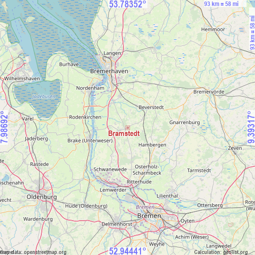
Bramstedt GPS coordinates[2]
53° 21' 57.708" North, 8° 41' 24.18" East
| Map corner | latitude | longitude |
|---|---|---|
| Upper-left | 53.78352°, | 7.98692° |
| Center: | 53.36603°, | 8.69005° |
| Lower-right: | 52.94441°, | 9.39317° |
| Map W x H: | 93.3×93.3 km | = 58×58mi |
| max Lat: | 55.01917° ⇑15.8% North |
| Bramstedt: | 53.36603° |
| min Lat: | ⇓84.2% South 47.40724° |
| min Long | Bramstedt | max Long |
| 5.92978° | 8.69005° | 14.98853° |
| W 30.8%⇐ | ⇒69.2% E |
Elevation
Elevation of Bramstedt is 20 m = 66 ft, and this is 229.1 m = 752 ft below average elevation for this country.
| Max E: |
1256 m = 4121 ft | 90.5% |
| Avg. | 249.1 m = 817 ft | |
| Bramstedt | 20 m = 66 ft | |
Min E: |
-5 m = -16 ft | 9.5% |
See also: Germany elevation on elevation.city.
Geographical zone
Bramstedt is located in North temperate zone (between Tropic of Cancer and the Arctic Circle). Distance of this North polar circle is 1467.4 km =911.8 mi to North.| Distance of | km | miles | from Bramstedt |
|---|---|---|---|
| North Pole | 4073.3 | 2531 | to North |
| Arctic Circle | 1467.4 | 911.8 | to North |
| Tropic Cancer | 3327.8 | 2067.8 | to South |
| Equator | 5933.7 | 3687 | to South |


Nearby cities:
15 places around Bramstedt: (largest is in red/bold)
• Axstedt
5.8 km =3.6 mi,  102°
102°
• Beverstedt
11.4 km =7.1 mi,  48°
48°
• Bokel
6 km =3.7 mi,  59°
59°
• Driftsethe
5.2 km =3.2 mi,  291°
291°
• Hagen im Bremischen
3.3 km =2.1 mi,  252°
252°
• Hambergen
11 km =6.8 mi,  125°
125°
• Heerstedt
11.9 km =7.4 mi,  22°
22°
• Hollen
6.6 km =4.1 mi,  8°
8°
• Loxstedt
11.5 km =7.1 mi,  346°
346°
• Lunestedt
8.8 km =5.5 mi,  27°
27°
• Lübberstedt
8.2 km =5.1 mi,  116°
116°
• Sandstedt
11.2 km =7 mi,  266°
266°
• Stinstedt
12 km =7.5 mi, 6°
• Uthlede
9.6 km =6 mi,  230°
230°
• Wulsbüttel
5.7 km =3.5 mi,  195°
195°
Sources, notices
• [Note1] Compared only with cities in Germany existing in our database
• [Src1] Map data: © OpenStreetMap contributors (CC-BY-SA)
• [Src2] Other city data from geonames.org with taken over terms of usage.
• [Src3] Geographical zone / Annual Mean Temperature by Robert A. Rohde @ Wikipedia
