Knappenrode geodata
Knappenrode (Saxony) is a populated place; located in Germany in Europe/Berlin (GMT+2) time zone. With population of 713 people, there are 8260 cities with bigger population in this country. Compared to other cities in Germany, 64.8% of cities are located further ↓South; 98.9% of cities are located further ←West and 64.2% of cities have higher elevation than Knappenrode. Note1


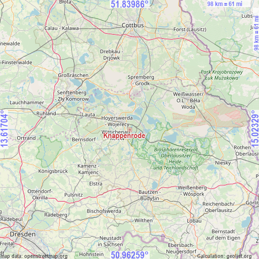
Knappenrode GPS coordinates[2]
51° 24' 11.988" North, 14° 19' 12.576" East
| Map corner | latitude | longitude |
|---|---|---|
| Upper-left | 51.83986°, | 13.61704° |
| Center: | 51.40333°, | 14.32016° |
| Lower-right: | 50.96259°, | 15.02329° |
| Map W x H: | 97.5×97.5 km | = 60.6×60.6mi |
| max Lat: | 55.01917° ⇑35.2% North |
| Knappenrode: | 51.40333° |
| min Lat: | ⇓64.8% South 47.40724° |
| min Long | Knappenrode | max Long |
| 5.92978° | 14.32016° | 14.98853° |
| W 98.9%⇐ | ⇒1.1% E |
Elevation
Elevation of Knappenrode is 125 m = 410 ft, and this is 124.1 m = 407 ft below average elevation for this country.
| Max E: |
1256 m = 4121 ft | 64.2% |
| Avg. | 249.1 m = 817 ft | |
| Knappenrode | 125 m = 410 ft | |
Min E: |
-5 m = -16 ft | 35.8% |
See also: Germany elevation on elevation.city.
Geographical zone
Knappenrode is located in North temperate zone (between Tropic of Cancer and the Arctic Circle). Distance of this North polar circle is 1685.7 km =1047.4 mi to North.| Distance of | km | miles | from Knappenrode |
|---|---|---|---|
| North Pole | 4291.5 | 2666.6 | to North |
| Arctic Circle | 1685.7 | 1047.4 | to North |
| Tropic Cancer | 3109.6 | 1932.2 | to South |
| Equator | 5715.5 | 3551.4 | to South |


Nearby cities:
15 places around Knappenrode: (largest is in red/bold)
• Bernsdorf
17.7 km =11 mi,  259°
259°
• Boxberg
17.7 km =11 mi,  89°
89°
• Haidemühl
17.9 km =11.1 mi,  337°
337°
• Horka
16.2 km =10.1 mi,  196°
196°
• Hoyerswerda
7 km =4.3 mi,  303°
303°
• Königswartha
10.4 km =6.5 mi,  176°
176°
• Lohsa
6 km =3.7 mi,  111°
111°
• Neschwitz
14.8 km =9.2 mi, 177°
• Oßling
11.8 km =7.3 mi,  245°
245°
• Puschwitz
16.5 km =10.3 mi, 184°
• Radibor
18.4 km =11.4 mi,  162°
162°
• Räckelwitz
18.1 km =11.2 mi, 199°
• Straßgräbchen
18.7 km =11.6 mi, 252°
• Uhyst
13.6 km =8.5 mi, 108°
• Wittichenau
5.7 km =3.5 mi, 248°
Sources, notices
• [Note1] Compared only with cities in Germany existing in our database
• [Src1] Map data: © OpenStreetMap contributors (CC-BY-SA)
• [Src2] Other city data from geonames.org with taken over terms of usage.
• [Src3] Geographical zone / Annual Mean Temperature by Robert A. Rohde @ Wikipedia
