Borgholzhausen geodata
Borgholzhausen (North Rhine-Westphalia) is a populated place; located in Germany in Europe/Berlin (GMT+2) time zone. With population of 8,754 people, there are 1832 cities with bigger population in this country. Compared to other cities in Germany, 73% of cities are located further ↓South; 72.9% of cities are located further →East and 62.9% of cities have higher elevation than Borgholzhausen. Note1
Administrative division(s):
- Level 1: North Rhine-Westphalia
- Level 2: Regierungsbezirk Detmold
- Level 3: Kreis Gütersloh
- Level 4: Borgholzhausen


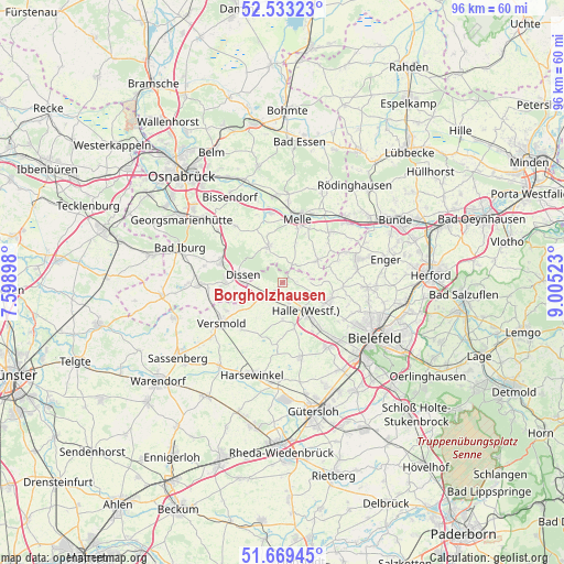
Borgholzhausen GPS coordinates[2]
52° 6' 12.348" North, 8° 18' 7.596" East
| Map corner | latitude | longitude |
|---|---|---|
| Upper-left | 52.53323°, | 7.59898° |
| Center: | 52.10343°, | 8.30211° |
| Lower-right: | 51.66945°, | 9.00523° |
| Map W x H: | 96×96 km | = 59.7×59.7mi |
| max Lat: | 55.01917° ⇑27% North |
| Borgholzhausen: | 52.10343° |
| min Lat: | ⇓73% South 47.40724° |
| min Long | Borgholzhausen | max Long |
| 5.92978° | 8.30211° | 14.98853° |
| W 27.1%⇐ | ⇒72.9% E |
Elevation
Elevation of Borgholzhausen is 133 m = 436 ft, and this is 116.1 m = 381 ft below average elevation for this country.
| Max E: |
1256 m = 4121 ft | 62.9% |
| Avg. | 249.1 m = 817 ft | |
| Borgholzhausen | 133 m = 436 ft | |
Min E: |
-5 m = -16 ft | 37.1% |
See also: Germany elevation on elevation.city.
Geographical zone
Borgholzhausen is located in North temperate zone (between Tropic of Cancer and the Arctic Circle). Distance of this North polar circle is 1607.8 km =999 mi to North.| Distance of | km | miles | from Borgholzhausen |
|---|---|---|---|
| North Pole | 4213.7 | 2618.3 | to North |
| Arctic Circle | 1607.8 | 999 | to North |
| Tropic Cancer | 3187.4 | 1980.6 | to South |
| Equator | 5793.4 | 3599.9 | to South |


Nearby cities:
15 places around Borgholzhausen: (largest is in red/bold)
• Bad Laer
14.9 km =9.3 mi,  268°
268°
• Bad Rothenfelde
9.4 km =5.8 mi,  279°
279°
• Bielefeld
17.6 km =10.9 mi,  116°
116°
• Bissendorf
17.1 km =10.6 mi,  327°
327°
• Dissen
7.1 km =4.4 mi, 281°
• Enger
17.9 km =11.1 mi,  76°
76°
• Halle
6.3 km =3.9 mi,  140°
140°
• Harsewinkel
16.5 km =10.3 mi,  197°
197°
• Hilter
11.2 km =7 mi,  288°
288°
• Melle
11.2 km =7 mi,  12°
12°
• Neuenkirchen
7 km =4.3 mi,  57°
57°
• Spenge
13.1 km =8.1 mi,  71°
71°
• Steinhagen
13.3 km =8.3 mi,  149°
149°
• Versmold
12.4 km =7.7 mi,  235°
235°
• Werther
8.4 km =5.2 mi,  109°
109°
Sources, notices
• [Note1] Compared only with cities in Germany existing in our database
• [Src1] Map data: © OpenStreetMap contributors (CC-BY-SA)
• [Src2] Other city data from geonames.org with taken over terms of usage.
• [Src3] Geographical zone / Annual Mean Temperature by Robert A. Rohde @ Wikipedia
