Oranienburg geodata
Oranienburg (Brandenburg) is a seat of a third-order administrative division; located in Germany in Europe/Berlin (GMT+2) time zone. With population of 40,793 people, there are 313 cities with bigger population in this country. Compared to other cities in Germany, 80.1% of cities are located further ↓South; 93.9% of cities are located further ←West and 84.9% of cities have higher elevation than Oranienburg. Note1


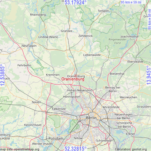
Oranienburg GPS coordinates[2]
52° 45' 20.772" North, 13° 14' 31.092" East
| Map corner | latitude | longitude |
|---|---|---|
| Upper-left | 53.17924°, | 12.53885° |
| Center: | 52.75577°, | 13.24197° |
| Lower-right: | 52.32815°, | 13.9451° |
| Map W x H: | 94.6×94.6 km | = 58.8×58.8mi |
| max Lat: | 55.01917° ⇑19.9% North |
| Oranienburg: | 52.75577° |
| min Lat: | ⇓80.1% South 47.40724° |
| min Long | Oranienburg | max Long |
| 5.92978° | 13.24197° | 14.98853° |
| W 93.9%⇐ | ⇒6.1% E |
Elevation
Elevation of Oranienburg is 35 m = 115 ft, and this is 214.1 m = 702 ft below average elevation for this country.
| Max E: |
1256 m = 4121 ft | 84.9% |
| Avg. | 249.1 m = 817 ft | |
| Oranienburg | 35 m = 115 ft | |
Min E: |
-5 m = -16 ft | 15.1% |
See also: Oranienburg elevation on elevation.city.
Geographical zone
Oranienburg is located in North temperate zone (between Tropic of Cancer and the Arctic Circle). Distance of this North polar circle is 1535.3 km =954 mi to North.| Distance of | km | miles | from Oranienburg |
|---|---|---|---|
| North Pole | 4141.2 | 2573.2 | to North |
| Arctic Circle | 1535.3 | 954 | to North |
| Tropic Cancer | 3260 | 2025.7 | to South |
| Equator | 5865.9 | 3644.9 | to South |


Nearby cities:
15 places around Oranienburg: (largest is in red/bold)
• Birkenwerder
8.5 km =5.3 mi,  160°
160°
• Blankenfelde
18.2 km =11.3 mi,  146°
146°
• Frohnau
14 km =8.7 mi,  166°
166°
• Glienicke
14.7 km =9.1 mi, 157°
• Heiligensee
15.7 km =9.8 mi,  179°
179°
• Hennigsdorf
13.6 km =8.5 mi,  190°
190°
• Hermsdorf
16.3 km =10.1 mi, 164°
• Hohen Neuendorf
9.2 km =5.7 mi, 164°
• Kremmen
14.6 km =9.1 mi,  272°
272°
• Leegebruch
4.9 km =3 mi,  222°
222°
• Liebenwalde
16.4 km =10.2 mi,  38°
38°
• Lübars
17.3 km =10.7 mi, 154°
• Velten
8.4 km =5.2 mi,  212°
212°
• Waidmannslust
17.4 km =10.8 mi, 162°
• Wandlitz
14.6 km =9.1 mi,  96°
96°
Sources, notices
• [Note1] Compared only with cities in Germany existing in our database
• [Src1] Map data: © OpenStreetMap contributors (CC-BY-SA)
• [Src2] Other city data from geonames.org with taken over terms of usage.
• [Src3] Geographical zone / Annual Mean Temperature by Robert A. Rohde @ Wikipedia
