Alzenau in Unterfranken geodata
Alzenau in Unterfranken (Bavaria) is a populated place; located in Germany in Europe/Berlin (GMT+2) time zone. With population of 18,932 people, there are 825 cities with bigger population in this country. Compared to other cities in Germany, 61.6% of cities are located further ↑North; 64.6% of cities are located further →East and 63% of cities have higher elevation than Alzenau in Unterfranken. Note1
Administrative division(s):
- Level 1: Bavaria
- Level 2: Regierungsbezirk Unterfranken
- Level 3: Landkreis Aschaffenburg
- Level 4: Alzenau i.UFr.
Current local time in Alzenau in Unterfranken:
03:50 PM, TuesdayDifference from your time zone: hours


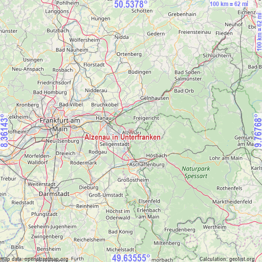
Alzenau in Unterfranken GPS coordinates[2]
50° 5' 19.68" North, 9° 3' 52.38" East
| Map corner | latitude | longitude |
|---|---|---|
| Upper-left | 50.5378°, | 8.36143° |
| Center: | 50.0888°, | 9.06455° |
| Lower-right: | 49.63555°, | 9.76768° |
| Map W x H: | 100.3×100.3 km | = 62.3×62.3mi |
| max Lat: | 55.01917° ⇑61.6% North |
| Alzenau in Unterfranken: | 50.0888° |
| min Lat: | ⇓38.4% South 47.40724° |
| min Long | Alzenau in Unte | max Long |
| 5.92978° | 9.06455° | 14.98853° |
| W 35.4%⇐ | ⇒64.6% E |
Elevation
Elevation of Alzenau in Unterfranken is 132 m = 433 ft, and this is 117.1 m = 384 ft below average elevation for this country.
| Max E: |
1256 m = 4121 ft | 63% |
| Avg. | 249.1 m = 817 ft | |
| Alzenau in Unterfranken | 132 m = 433 ft | |
Min E: |
-5 m = -16 ft | 37% |
See also: Germany elevation on elevation.city.
Geographical zone
Alzenau in Unterfranken is located in North temperate zone (between Tropic of Cancer and the Arctic Circle). Distance of this North polar circle is 1831.8 km =1138.2 mi to North.| Distance of | km | miles | from Alzenau in Unterfranken |
|---|---|---|---|
| North Pole | 4437.7 | 2757.5 | to North |
| Arctic Circle | 1831.8 | 1138.2 | to North |
| Tropic Cancer | 2963.4 | 1841.4 | to South |
| Equator | 5569.4 | 3460.7 | to South |


Nearby cities:
15 places around Alzenau in Unterfranken: (largest is in red/bold)
• Blankenbach
12.3 km =7.6 mi,  101°
101°
• Erlensee
10.3 km =6.4 mi,  323°
323°
• Geiselbach
10.2 km =6.3 mi,  67°
67°
• Glattbach
11.6 km =7.2 mi,  148°
148°
• Großkrotzenburg
5.8 km =3.6 mi,  264°
264°
• Hanau am Main
11.9 km =7.4 mi,  295°
295°
• Johannesberg
8.5 km =5.3 mi,  138°
138°
• Kahl am Main
4.7 km =2.9 mi,  243°
243°
• Kleinostheim
9.9 km =6.2 mi,  179°
179°
• Krombach
10.1 km =6.3 mi,  93°
93°
• Langenselbold
9.9 km =6.2 mi,  349°
349°
• Mainaschaff
12 km =7.5 mi,  171°
171°
• Mömbris
7.4 km =4.6 mi,  107°
107°
• Rodenbach
7.2 km =4.5 mi,  341°
341°
• Seligenstadt
8.2 km =5.1 mi,  231°
231°
Sources, notices
• [Note1] Compared only with cities in Germany existing in our database
• [Src1] Map data: © OpenStreetMap contributors (CC-BY-SA)
• [Src2] Other city data from geonames.org with taken over terms of usage.
• [Src3] Geographical zone / Annual Mean Temperature by Robert A. Rohde @ Wikipedia
