Großkrotzenburg geodata
Großkrotzenburg (Hesse) is a seat of a fourth-order administrative division; located in Germany in Europe/Berlin (GMT+2) time zone. With population of 7,196 people, there are 2142 cities with bigger population in this country. Compared to other cities in Germany, 61.8% of cities are located further ↑North; 65.7% of cities are located further →East and 66.9% of cities have higher elevation than Großkrotzenburg. Note1
Administrative division(s):
- Level 1: Hesse
- Level 2: Regierungsbezirk Darmstadt
- Level 3: Main-Kinzig-Kreis
- Level 4: Großkrotzenburg


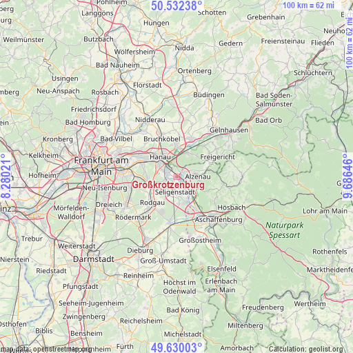
Großkrotzenburg GPS coordinates[2]
50° 4' 59.988" North, 8° 58' 59.988" East
| Map corner | latitude | longitude |
|---|---|---|
| Upper-left | 50.53238°, | 8.28021° |
| Center: | 50.08333°, | 8.98333° |
| Lower-right: | 49.63003°, | 9.68646° |
| Map W x H: | 100.3×100.3 km | = 62.3×62.3mi |
| max Lat: | 55.01917° ⇑61.8% North |
| Großkrotzenburg: | 50.08333° |
| min Lat: | ⇓38.2% South 47.40724° |
| min Long | Großkrotzenbur | max Long |
| 5.92978° | 8.98333° | 14.98853° |
| W 34.3%⇐ | ⇒65.7% E |
Elevation
Elevation of Großkrotzenburg is 109 m = 358 ft, and this is 140.1 m = 460 ft below average elevation for this country.
| Max E: |
1256 m = 4121 ft | 66.9% |
| Avg. | 249.1 m = 817 ft | |
| Großkrotzenburg | 109 m = 358 ft | |
Min E: |
-5 m = -16 ft | 33.1% |
See also: Germany elevation on elevation.city.
Geographical zone
Großkrotzenburg is located in North temperate zone (between Tropic of Cancer and the Arctic Circle). Distance of this North polar circle is 1832.4 km =1138.6 mi to North.| Distance of | km | miles | from Großkrotzenburg |
|---|---|---|---|
| North Pole | 4438.3 | 2757.8 | to North |
| Arctic Circle | 1832.4 | 1138.6 | to North |
| Tropic Cancer | 2962.8 | 1841 | to South |
| Equator | 5568.7 | 3460.2 | to South |


Nearby cities:
15 places around Großkrotzenburg: (largest is in red/bold)
• Alzenau in Unterfranken
5.8 km =3.6 mi,  84°
84°
• Bruchköbel
11.4 km =7.1 mi,  337°
337°
• Erlensee
8.9 km =5.5 mi,  357°
357°
• Hanau am Main
7.5 km =4.7 mi,  318°
318°
• Johannesberg
12.7 km =7.9 mi,  116°
116°
• Kahl am Main
2.2 km =1.4 mi,  133°
133°
• Kleinostheim
11 km =6.8 mi,  147°
147°
• Langenselbold
11.1 km =6.9 mi,  21°
21°
• Maintal
13 km =8.1 mi,  304°
304°
• Mömbris
13 km =8.1 mi,  96°
96°
• Mühlheim am Main
11.3 km =7 mi,  289°
289°
• Obertshausen
9.5 km =5.9 mi,  261°
261°
• Rodenbach
8.2 km =5.1 mi,  25°
25°
• Rodgau
9.4 km =5.8 mi,  227°
227°
• Seligenstadt
4.5 km =2.8 mi,  188°
188°
Sources, notices
• [Note1] Compared only with cities in Germany existing in our database
• [Src1] Map data: © OpenStreetMap contributors (CC-BY-SA)
• [Src2] Other city data from geonames.org with taken over terms of usage.
• [Src3] Geographical zone / Annual Mean Temperature by Robert A. Rohde @ Wikipedia
