Albstadt geodata
Albstadt (Baden-Württemberg) is a populated place; located in Germany in Europe/Berlin (GMT+2) time zone. With population of 46,664 people, there are 248 cities with bigger population in this country. Compared to other cities in Germany, 92.5% of cities are located further ↑North; 65% of cities are located further →East and 98.4% of cities have lower elevation than Albstadt. Note1
Administrative division(s):
- Level 1: Baden-Württemberg
- Level 2: Tübingen Region
- Level 3: Zollernalbkreis
- Level 4: Albstadt


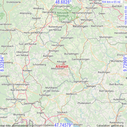
Albstadt GPS coordinates[2]
48° 12' 59.184" North, 9° 1' 33.456" East
| Map corner | latitude | longitude |
|---|---|---|
| Upper-left | 48.6828°, | 8.32284° |
| Center: | 48.21644°, | 9.02596° |
| Lower-right: | 47.74579°, | 9.72909° |
| Map W x H: | 104.2×104.2 km | = 64.7×64.7mi |
| max Lat: | 55.01917° ⇑92.5% North |
| Albstadt: | 48.21644° |
| min Lat: | ⇓7.5% South 47.40724° |
| min Long | Albstadt | max Long |
| 5.92978° | 9.02596° | 14.98853° |
| W 35%⇐ | ⇒65% E |
Elevation
Elevation of Albstadt is 733 m = 2405 ft, and this is 483.9 m = 1588 ft above average elevation for this country.
| Max E: |
1256 m = 4121 ft | 1.6% |
| Albstadt | 733 m 2405 ft | |
| Avg. | 249.1 m = 817 ft | |
Min E: |
-5 m = -16 ft | 98.4% |
See also: Albstadt elevation on elevation.city.
Geographical zone
Albstadt is located in North temperate zone (between Tropic of Cancer and the Arctic Circle). Distance of this North polar circle is 2040 km =1267.6 mi to North.| Distance of | km | miles | from Albstadt |
|---|---|---|---|
| North Pole | 4645.9 | 2886.8 | to North |
| Arctic Circle | 2040 | 1267.6 | to North |
| Tropic Cancer | 2755.2 | 1712 | to South |
| Equator | 5361.2 | 3331.3 | to South |


Nearby cities:
15 places around Albstadt: (largest is in red/bold)
• Balingen
14.3 km =8.9 mi,  297°
297°
• Bisingen
13.2 km =8.2 mi,  322°
322°
• Bitz
5.7 km =3.5 mi,  57°
57°
• Burladingen
10.5 km =6.5 mi,  37°
37°
• Hausen am Tann
14.2 km =8.8 mi,  261°
261°
• Jungingen
12.4 km =7.7 mi,  5°
5°
• Meßstetten
5.8 km =3.6 mi,  230°
230°
• Neufra
12.1 km =7.5 mi,  73°
73°
• Nusplingen
13.6 km =8.5 mi, 226°
• Obernheim
13.6 km =8.5 mi,  244°
244°
• Schwenningen
13.1 km =8.1 mi,  188°
188°
• Stetten am Kalten Markt
11 km =6.8 mi,  159°
159°
• Straßberg
6.4 km =4 mi,  131°
131°
• Veringenstadt
14.1 km =8.8 mi,  104°
104°
• Winterlingen
7.7 km =4.8 mi,  118°
118°
Sources, notices
• [Note1] Compared only with cities in Germany existing in our database
• [Src1] Map data: © OpenStreetMap contributors (CC-BY-SA)
• [Src2] Other city data from geonames.org with taken over terms of usage.
• [Src3] Geographical zone / Annual Mean Temperature by Robert A. Rohde @ Wikipedia
