Aidenbach geodata
Aidenbach (Bavaria) is a populated place; located in Germany in Europe/Berlin (GMT+2) time zone. With population of 3,038 people, there are 3973 cities with bigger population in this country. Compared to other cities in Germany, 88.2% of cities are located further ↑North; 92.9% of cities are located further ←West and 69.7% of cities have lower elevation than Aidenbach. Note1
Administrative division(s):
- Level 1: Bavaria
- Level 2: Lower Bavaria
- Level 3: Landkreis Passau
- Level 4: Aidenbach, Markt


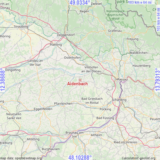
Aidenbach GPS coordinates[2]
48° 34' 13.008" North, 13° 5' 24" East
| Map corner | latitude | longitude |
|---|---|---|
| Upper-left | 49.0334°, | 12.38688° |
| Center: | 48.57028°, | 13.09° |
| Lower-right: | 48.10288°, | 13.79313° |
| Map W x H: | 103.5×103.5 km | = 64.3×64.3mi |
| max Lat: | 55.01917° ⇑88.2% North |
| Aidenbach: | 48.57028° |
| min Lat: | ⇓11.8% South 47.40724° |
| min Long | Aidenbach | max Long |
| 5.92978° | 13.09° | 14.98853° |
| W 92.9%⇐ | ⇒7.1% E |
Elevation
Elevation of Aidenbach is 356 m = 1168 ft, and this is 106.9 m = 351 ft above average elevation for this country.
| Max E: |
1256 m = 4121 ft | 30.3% |
| Aidenbach | 356 m 1168 ft | |
| Avg. | 249.1 m = 817 ft | |
Min E: |
-5 m = -16 ft | 69.7% |
See also: Germany elevation on elevation.city.
Geographical zone
Aidenbach is located in North temperate zone (between Tropic of Cancer and the Arctic Circle). Distance of this North polar circle is 2000.7 km =1243.2 mi to North.| Distance of | km | miles | from Aidenbach |
|---|---|---|---|
| North Pole | 4606.6 | 2862.4 | to North |
| Arctic Circle | 2000.7 | 1243.2 | to North |
| Tropic Cancer | 2794.6 | 1736.5 | to South |
| Equator | 5400.5 | 3355.7 | to South |


Nearby cities:
15 places around Aidenbach: (largest is in red/bold)
• Aldersbach
2.2 km =1.4 mi,  359°
359°
• Bad Birnbach
13.9 km =8.6 mi,  179°
179°
• Beutelsbach
3 km =1.9 mi,  138°
138°
• Dietersburg
14.9 km =9.3 mi,  234°
234°
• Egglham
5.3 km =3.3 mi,  209°
209°
• Haarbach
9 km =5.6 mi,  150°
150°
• Haibach
8.5 km =5.3 mi,  243°
243°
• Hofkirchen
12.2 km =7.6 mi,  10°
10°
• Johanniskirchen
11.1 km =6.9 mi,  248°
248°
• Künzing
10.7 km =6.6 mi, 357°
• Ortenburg
10.1 km =6.3 mi,  105°
105°
• Reut
3.4 km =2.1 mi,  45°
45°
• Rossbach
10.4 km =6.5 mi,  278°
278°
• Roßbach
12 km =7.5 mi,  286°
286°
• Vilshofen
9.8 km =6.1 mi, 50°
Sources, notices
• [Note1] Compared only with cities in Germany existing in our database
• [Src1] Map data: © OpenStreetMap contributors (CC-BY-SA)
• [Src2] Other city data from geonames.org with taken over terms of usage.
• [Src3] Geographical zone / Annual Mean Temperature by Robert A. Rohde @ Wikipedia
