Achstetten geodata
Achstetten (Baden-Württemberg) is a seat of a fourth-order administrative division; located in Germany in Europe/Berlin (GMT+2) time zone. With population of 3,978 people, there are 3315 cities with bigger population in this country. Compared to other cities in Germany, 91.8% of cities are located further ↑North; 51.6% of cities are located further →East and 88.9% of cities have lower elevation than Achstetten. Note1
Administrative division(s):
- Level 1: Baden-Württemberg
- Level 2: Tübingen Region
- Level 3: Landkreis Biberach
- Level 4: Achstetten


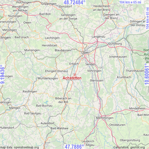
Achstetten GPS coordinates[2]
48° 15' 31.896" North, 9° 53' 50.928" East
| Map corner | latitude | longitude |
|---|---|---|
| Upper-left | 48.72484°, | 9.19436° |
| Center: | 48.25886°, | 9.89748° |
| Lower-right: | 47.7886°, | 10.60061° |
| Map W x H: | 104.1×104.1 km | = 64.7×64.7mi |
| max Lat: | 55.01917° ⇑91.8% North |
| Achstetten: | 48.25886° |
| min Lat: | ⇓8.2% South 47.40724° |
| min Long | Achstetten | max Long |
| 5.92978° | 9.89748° | 14.98853° |
| W 48.4%⇐ | ⇒51.6% E |
Elevation
Elevation of Achstetten is 503 m = 1650 ft, and this is 253.9 m = 833 ft above average elevation for this country.
| Max E: |
1256 m = 4121 ft | 11.1% |
| Achstetten | 503 m 1650 ft | |
| Avg. | 249.1 m = 817 ft | |
Min E: |
-5 m = -16 ft | 88.9% |
See also: Germany elevation on elevation.city.
Geographical zone
Achstetten is located in North temperate zone (between Tropic of Cancer and the Arctic Circle). Distance of this North polar circle is 2035.3 km =1264.7 mi to North.| Distance of | km | miles | from Achstetten |
|---|---|---|---|
| North Pole | 4641.2 | 2883.9 | to North |
| Arctic Circle | 2035.3 | 1264.7 | to North |
| Tropic Cancer | 2760 | 1715 | to South |
| Equator | 5365.9 | 3334.2 | to South |


Nearby cities:
15 places around Achstetten: (largest is in red/bold)
• Altheim
12.1 km =7.5 mi,  309°
309°
• Burgrieden
3.9 km =2.4 mi,  136°
136°
• Erbach
7.8 km =4.8 mi,  354°
354°
• Ersingen
4.9 km =3 mi,  320°
320°
• Griesingen
8.5 km =5.3 mi,  275°
275°
• Hüttisheim
4.1 km =2.5 mi,  55°
55°
• Illerrieden
11.5 km =7.1 mi,  83°
83°
• Laupheim
3.7 km =2.3 mi,  201°
201°
• Mietingen
8.4 km =5.2 mi,  178°
178°
• Oberdischingen
6.6 km =4.1 mi, 313°
• Schnürpflingen
7.2 km =4.5 mi, 77°
• Schwendi
11 km =6.8 mi,  148°
148°
• Staig
8.3 km =5.2 mi, 56°
• Wain
12 km =7.5 mi,  130°
130°
• Öpfingen
7.7 km =4.8 mi,  293°
293°
Sources, notices
• [Note1] Compared only with cities in Germany existing in our database
• [Src1] Map data: © OpenStreetMap contributors (CC-BY-SA)
• [Src2] Other city data from geonames.org with taken over terms of usage.
• [Src3] Geographical zone / Annual Mean Temperature by Robert A. Rohde @ Wikipedia
