Schnürpflingen geodata
Schnürpflingen (Baden-Württemberg) is a seat of a fourth-order administrative division; located in Germany in Europe/Berlin (GMT+2) time zone. With population of 1,322 people, there are 6245 cities with bigger population in this country. Compared to other cities in Germany, 91.6% of cities are located further ↑North; 50.1% of cities are located further →East and 90.2% of cities have lower elevation than Schnürpflingen. Note1
Administrative division(s):
- Level 1: Baden-Württemberg
- Level 2: Tübingen Region
- Level 3: Alb-Donau-Kreis
- Level 4: Schnürpflingen


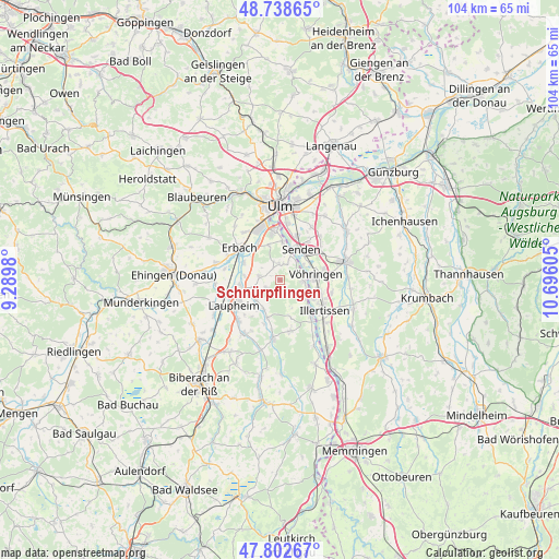
Schnürpflingen GPS coordinates[2]
48° 16' 22.08" North, 9° 59' 34.512" East
| Map corner | latitude | longitude |
|---|---|---|
| Upper-left | 48.73865°, | 9.2898° |
| Center: | 48.2728°, | 9.99292° |
| Lower-right: | 47.80267°, | 10.69605° |
| Map W x H: | 104.1×104.1 km | = 64.7×64.7mi |
| max Lat: | 55.01917° ⇑91.6% North |
| Schnürpflingen: | 48.2728° |
| min Lat: | ⇓8.4% South 47.40724° |
| min Long | Schnürpflingen | max Long |
| 5.92978° | 9.99292° | 14.98853° |
| W 49.9%⇐ | ⇒50.1% E |
Elevation
Elevation of Schnürpflingen is 517 m = 1696 ft, and this is 267.9 m = 879 ft above average elevation for this country.
| Max E: |
1256 m = 4121 ft | 9.8% |
| Schnürpflingen | 517 m 1696 ft | |
| Avg. | 249.1 m = 817 ft | |
Min E: |
-5 m = -16 ft | 90.2% |
See also: Germany elevation on elevation.city.
Geographical zone
Schnürpflingen is located in North temperate zone (between Tropic of Cancer and the Arctic Circle). Distance of this North polar circle is 2033.7 km =1263.7 mi to North.| Distance of | km | miles | from Schnürpflingen |
|---|---|---|---|
| North Pole | 4639.6 | 2882.9 | to North |
| Arctic Circle | 2033.7 | 1263.7 | to North |
| Tropic Cancer | 2761.5 | 1715.9 | to South |
| Equator | 5367.4 | 3335.1 | to South |


Nearby cities:
15 places around Schnürpflingen: (largest is in red/bold)
• Achstetten
7.2 km =4.5 mi,  257°
257°
• Bellenberg
7.5 km =4.7 mi,  103°
103°
• Burgrieden
6.2 km =3.9 mi,  225°
225°
• Dietenheim
9 km =5.6 mi,  139°
139°
• Erbach
10 km =6.2 mi,  308°
308°
• Ersingen
10.4 km =6.5 mi,  282°
282°
• Hüttisheim
3.8 km =2.4 mi, 281°
• Illerrieden
4.3 km =2.7 mi,  93°
93°
• Illertissen
9.9 km =6.2 mi,  123°
123°
• Laupheim
9.8 km =6.1 mi,  239°
239°
• Schwendi
11 km =6.8 mi,  186°
186°
• Senden
6.9 km =4.3 mi,  33°
33°
• Staig
3 km =1.9 mi,  357°
357°
• Vöhringen
6.6 km =4.1 mi,  84°
84°
• Wain
9.5 km =5.9 mi,  167°
167°
Sources, notices
• [Note1] Compared only with cities in Germany existing in our database
• [Src1] Map data: © OpenStreetMap contributors (CC-BY-SA)
• [Src2] Other city data from geonames.org with taken over terms of usage.
• [Src3] Geographical zone / Annual Mean Temperature by Robert A. Rohde @ Wikipedia
