Wain geodata
Wain (Baden-Württemberg) is a seat of a fourth-order administrative division; located in Germany in Europe/Berlin (GMT+2) time zone. With population of 1,586 people, there are 5706 cities with bigger population in this country. Compared to other cities in Germany, 92.8% of cities are located further ↑North; 50.5% of cities are located further ←West and 92.2% of cities have lower elevation than Wain. Note1
Administrative division(s):
- Level 1: Baden-Württemberg
- Level 2: Tübingen Region
- Level 3: Landkreis Biberach
- Level 4: Wain


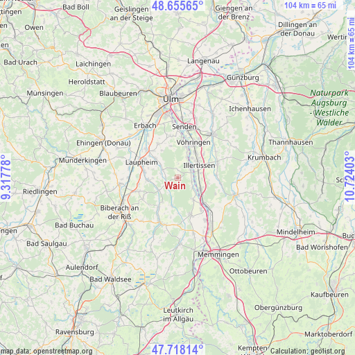
Wain GPS coordinates[2]
48° 11' 20.544" North, 10° 1' 15.24" East
| Map corner | latitude | longitude |
|---|---|---|
| Upper-left | 48.65565°, | 9.31778° |
| Center: | 48.18904°, | 10.0209° |
| Lower-right: | 47.71814°, | 10.72403° |
| Map W x H: | 104.2×104.2 km | = 64.7×64.7mi |
| max Lat: | 55.01917° ⇑92.8% North |
| Wain: | 48.18904° |
| min Lat: | ⇓7.2% South 47.40724° |
| min Long | Wain | max Long |
| 5.92978° | 10.0209° | 14.98853° |
| W 50.5%⇐ | ⇒49.5% E |
Elevation
Elevation of Wain is 545 m = 1788 ft, and this is 295.9 m = 971 ft above average elevation for this country.
| Max E: |
1256 m = 4121 ft | 7.8% |
| Wain | 545 m 1788 ft | |
| Avg. | 249.1 m = 817 ft | |
Min E: |
-5 m = -16 ft | 92.2% |
See also: Germany elevation on elevation.city.
Geographical zone
Wain is located in North temperate zone (between Tropic of Cancer and the Arctic Circle). Distance of this North polar circle is 2043.1 km =1269.5 mi to North.| Distance of | km | miles | from Wain |
|---|---|---|---|
| North Pole | 4648.9 | 2888.7 | to North |
| Arctic Circle | 2043.1 | 1269.5 | to North |
| Tropic Cancer | 2752.2 | 1710.1 | to South |
| Equator | 5358.1 | 3329.4 | to South |


Nearby cities:
15 places around Wain: (largest is in red/bold)
• Altenstadt
7.6 km =4.7 mi,  114°
114°
• Bellenberg
9.2 km =5.7 mi,  34°
34°
• Burgrieden
8.1 km =5 mi,  307°
307°
• Dietenheim
4.5 km =2.8 mi,  57°
57°
• Gutenzell-Hürbel
8.5 km =5.3 mi,  199°
199°
• Illerrieden
9.3 km =5.8 mi,  14°
14°
• Illertissen
7.2 km =4.5 mi, 58°
• Kellmünz
10.9 km =6.8 mi,  133°
133°
• Kirchberg an der Iller
7.7 km =4.8 mi,  143°
143°
• Laupheim
11.4 km =7.1 mi,  292°
292°
• Mietingen
9 km =5.6 mi,  265°
265°
• Schnürpflingen
9.5 km =5.9 mi,  347°
347°
• Schwendi
3.8 km =2.4 mi,  243°
243°
• Unterroth
11.2 km =7 mi,  86°
86°
• Vöhringen
10.9 km =6.8 mi,  24°
24°
Sources, notices
• [Note1] Compared only with cities in Germany existing in our database
• [Src1] Map data: © OpenStreetMap contributors (CC-BY-SA)
• [Src2] Other city data from geonames.org with taken over terms of usage.
• [Src3] Geographical zone / Annual Mean Temperature by Robert A. Rohde @ Wikipedia
