Linkenheim-Hochstetten geodata
Linkenheim-Hochstetten (Baden-Württemberg) is a seat of a fourth-order administrative division; located in Germany in Europe/Berlin (GMT+2) time zone. With population of 11,599 people, there are 1416 cities with bigger population in this country. Compared to other cities in Germany, 81.4% of cities are located further ↑North; 71.8% of cities are located further →East and 67.3% of cities have higher elevation than Linkenheim-Hochstetten. Note1
Administrative division(s):
- Level 1: Baden-Württemberg
- Level 2: Karlsruhe Region
- Level 3: Landkreis Karlsruhe
- Level 4: Linkenheim-Hochstetten
Current local time in Linkenheim-Hochstetten:
11:56 AM, TuesdayDifference from your time zone: hours


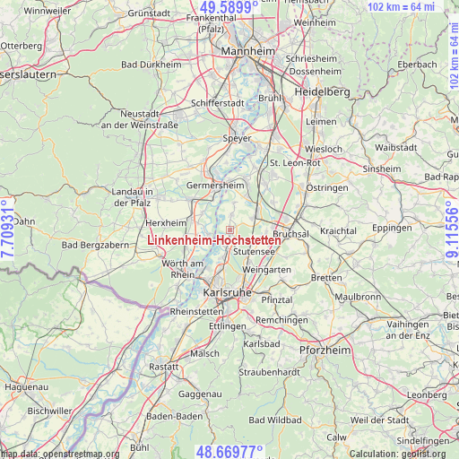
Linkenheim-Hochstetten GPS coordinates[2]
49° 7' 55.092" North, 8° 24' 44.784" East
| Map corner | latitude | longitude |
|---|---|---|
| Upper-left | 49.5899°, | 7.70931° |
| Center: | 49.13197°, | 8.41244° |
| Lower-right: | 48.66977°, | 9.11556° |
| Map W x H: | 102.3×102.3 km | = 63.6×63.6mi |
| max Lat: | 55.01917° ⇑81.4% North |
| Linkenheim-Hochstetten: | 49.13197° |
| min Lat: | ⇓18.6% South 47.40724° |
| min Long | Linkenheim-Hoch | max Long |
| 5.92978° | 8.41244° | 14.98853° |
| W 28.2%⇐ | ⇒71.8% E |
Elevation
Elevation of Linkenheim-Hochstetten is 106 m = 348 ft, and this is 143.1 m = 469 ft below average elevation for this country.
| Max E: |
1256 m = 4121 ft | 67.3% |
| Avg. | 249.1 m = 817 ft | |
| Linkenheim-Hochstetten | 106 m = 348 ft | |
Min E: |
-5 m = -16 ft | 32.7% |
See also: Germany elevation on elevation.city.
Geographical zone
Linkenheim-Hochstetten is located in North temperate zone (between Tropic of Cancer and the Arctic Circle). Distance of this North polar circle is 1938.2 km =1204.3 mi to North.| Distance of | km | miles | from Linkenheim-Hochstetten |
|---|---|---|---|
| North Pole | 4544.1 | 2823.6 | to North |
| Arctic Circle | 1938.2 | 1204.3 | to North |
| Tropic Cancer | 2857 | 1775.3 | to South |
| Equator | 5463 | 3394.5 | to South |


Nearby cities:
15 places around Linkenheim-Hochstetten: (largest is in red/bold)
• Eggenstein-Leopoldshafen
4.8 km =3 mi,  192°
192°
• Germersheim
10.7 km =6.6 mi,  340°
340°
• Graben-Neudorf
7 km =4.3 mi,  56°
56°
• Hambrücken
11.3 km =7 mi, 55°
• Herxheimweyher
11.7 km =7.3 mi,  281°
281°
• Hördt
7.3 km =4.5 mi,  301°
301°
• Jockgrim
10.9 km =6.8 mi,  246°
246°
• Karlsdorf-Neuthard
8.6 km =5.3 mi,  87°
87°
• Kuhardt
7.3 km =4.5 mi, 282°
• Leimersheim
5 km =3.1 mi,  259°
259°
• Neupotz
6.9 km =4.3 mi, 256°
• Philippsburg
11.6 km =7.2 mi,  17°
17°
• Rheinzabern
9.9 km =6.2 mi, 261°
• Rülzheim
9 km =5.6 mi,  285°
285°
• Weingarten
12 km =7.5 mi,  135°
135°
Sources, notices
• [Note1] Compared only with cities in Germany existing in our database
• [Src1] Map data: © OpenStreetMap contributors (CC-BY-SA)
• [Src2] Other city data from geonames.org with taken over terms of usage.
• [Src3] Geographical zone / Annual Mean Temperature by Robert A. Rohde @ Wikipedia
