Eggenstein-Leopoldshafen geodata
Eggenstein-Leopoldshafen (Baden-Württemberg) is a seat of a fourth-order administrative division; located in Germany in Europe/Berlin (GMT+2) time zone. With population of 15,189 people, there are 1056 cities with bigger population in this country. Compared to other cities in Germany, 81.9% of cities are located further ↑North; 72% of cities are located further →East and 66.7% of cities have higher elevation than Eggenstein-Leopoldshafen. Note1
Administrative division(s):
- Level 1: Baden-Württemberg
- Level 2: Karlsruhe Region
- Level 3: Landkreis Karlsruhe
- Level 4: Eggenstein-Leopoldshafen
Current local time in Eggenstein-Leopoldshafen:
01:08 PM, TuesdayDifference from your time zone: hours


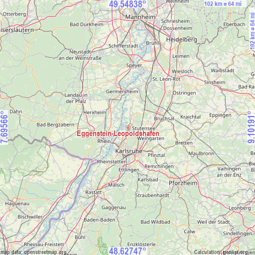
Eggenstein-Leopoldshafen GPS coordinates[2]
49° 5' 24.216" North, 8° 23' 55.644" East
| Map corner | latitude | longitude |
|---|---|---|
| Upper-left | 49.54838°, | 7.69566° |
| Center: | 49.09006°, | 8.39879° |
| Lower-right: | 48.62747°, | 9.10191° |
| Map W x H: | 102.4×102.4 km | = 63.6×63.6mi |
| max Lat: | 55.01917° ⇑81.9% North |
| Eggenstein-Leopoldshafen: | 49.09006° |
| min Lat: | ⇓18.1% South 47.40724° |
| min Long | Eggenstein-Leop | max Long |
| 5.92978° | 8.39879° | 14.98853° |
| W 28%⇐ | ⇒72% E |
Elevation
Elevation of Eggenstein-Leopoldshafen is 110 m = 361 ft, and this is 139.1 m = 456 ft below average elevation for this country.
| Max E: |
1256 m = 4121 ft | 66.7% |
| Avg. | 249.1 m = 817 ft | |
| Eggenstein-Leopoldshafen | 110 m = 361 ft | |
Min E: |
-5 m = -16 ft | 33.3% |
See also: Germany elevation on elevation.city.
Geographical zone
Eggenstein-Leopoldshafen is located in North temperate zone (between Tropic of Cancer and the Arctic Circle). Distance of this North polar circle is 1942.9 km =1207.3 mi to North.| Distance of | km | miles | from Eggenstein-Leopoldshafen |
|---|---|---|---|
| North Pole | 4548.8 | 2826.5 | to North |
| Arctic Circle | 1942.9 | 1207.3 | to North |
| Tropic Cancer | 2852.4 | 1772.4 | to South |
| Equator | 5458.3 | 3391.6 | to South |


Nearby cities:
15 places around Eggenstein-Leopoldshafen: (largest is in red/bold)
• Graben-Neudorf
10.9 km =6.8 mi,  38°
38°
• Hatzenbühl
11.4 km =7.1 mi,  281°
281°
• Herxheimweyher
12.6 km =7.8 mi,  303°
303°
• Hördt
9.9 km =6.2 mi,  327°
327°
• Jockgrim
9 km =5.6 mi,  271°
271°
• Karlsdorf-Neuthard
10.8 km =6.7 mi,  62°
62°
• Karlsruhe
9 km =5.6 mi,  177°
177°
• Kuhardt
8.7 km =5.4 mi,  315°
315°
• Leimersheim
5.4 km =3.4 mi,  314°
314°
• Linkenheim-Hochstetten
4.8 km =3 mi,  12°
12°
• Neupotz
6.5 km =4 mi, 298°
• Rheinzabern
9.3 km =5.8 mi,  289°
289°
• Rülzheim
10.4 km =6.5 mi, 312°
• Weingarten
10.1 km =6.3 mi,  112°
112°
• Wörth am Rhein
11.1 km =6.9 mi,  245°
245°
Sources, notices
• [Note1] Compared only with cities in Germany existing in our database
• [Src1] Map data: © OpenStreetMap contributors (CC-BY-SA)
• [Src2] Other city data from geonames.org with taken over terms of usage.
• [Src3] Geographical zone / Annual Mean Temperature by Robert A. Rohde @ Wikipedia
