Karlsdorf-Neuthard geodata
Karlsdorf-Neuthard (Baden-Württemberg) is a seat of a fourth-order administrative division; located in Germany in Europe/Berlin (GMT+2) time zone. With population of 9,329 people, there are 1730 cities with bigger population in this country. Compared to other cities in Germany, 81.3% of cities are located further ↑North; 70.8% of cities are located further →East and 66.7% of cities have higher elevation than Karlsdorf-Neuthard. Note1
Administrative division(s):
- Level 1: Baden-Württemberg
- Level 2: Karlsruhe Region
- Level 3: Landkreis Karlsruhe
- Level 4: Karlsdorf-Neuthard


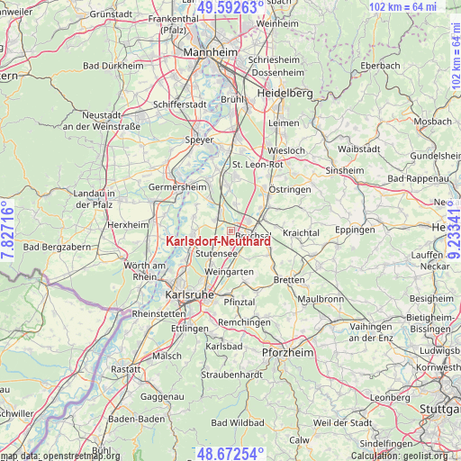
Karlsdorf-Neuthard GPS coordinates[2]
49° 8' 4.992" North, 8° 31' 49.008" East
| Map corner | latitude | longitude |
|---|---|---|
| Upper-left | 49.59263°, | 7.82716° |
| Center: | 49.13472°, | 8.53028° |
| Lower-right: | 48.67254°, | 9.23341° |
| Map W x H: | 102.3×102.3 km | = 63.6×63.6mi |
| max Lat: | 55.01917° ⇑81.3% North |
| Karlsdorf-Neuthard: | 49.13472° |
| min Lat: | ⇓18.7% South 47.40724° |
| min Long | Karlsdorf-Neuth | max Long |
| 5.92978° | 8.53028° | 14.98853° |
| W 29.2%⇐ | ⇒70.8% E |
Elevation
Elevation of Karlsdorf-Neuthard is 110 m = 361 ft, and this is 139.1 m = 456 ft below average elevation for this country.
| Max E: |
1256 m = 4121 ft | 66.7% |
| Avg. | 249.1 m = 817 ft | |
| Karlsdorf-Neuthard | 110 m = 361 ft | |
Min E: |
-5 m = -16 ft | 33.3% |
See also: Germany elevation on elevation.city.
Geographical zone
Karlsdorf-Neuthard is located in North temperate zone (between Tropic of Cancer and the Arctic Circle). Distance of this North polar circle is 1937.9 km =1204.2 mi to North.| Distance of | km | miles | from Karlsdorf-Neuthard |
|---|---|---|---|
| North Pole | 4543.8 | 2823.4 | to North |
| Arctic Circle | 1937.9 | 1204.2 | to North |
| Tropic Cancer | 2857.3 | 1775.4 | to South |
| Equator | 5463.3 | 3394.7 | to South |


Nearby cities:
15 places around Karlsdorf-Neuthard: (largest is in red/bold)
• Bruchsal
5.1 km =3.2 mi,  103°
103°
• Eggenstein-Leopoldshafen
10.8 km =6.7 mi,  242°
242°
• Forst
4.5 km =2.8 mi,  54°
54°
• Gondelsheim
12.5 km =7.8 mi,  132°
132°
• Graben-Neudorf
4.5 km =2.8 mi,  322°
322°
• Hambrücken
6.2 km =3.9 mi,  6°
6°
• Jöhlingen
11.8 km =7.3 mi,  164°
164°
• Kraichtal
14.8 km =9.2 mi,  85°
85°
• Kronau
12.2 km =7.6 mi,  36°
36°
• Leimersheim
13.5 km =8.4 mi,  265°
265°
• Linkenheim-Hochstetten
8.6 km =5.3 mi, 267°
• Philippsburg
11.9 km =7.4 mi,  334°
334°
• Ubstadt-Weiher
8 km =5 mi,  66°
66°
• Waghäusel
12.9 km =8 mi,  354°
354°
• Weingarten
8.9 km =5.5 mi,  181°
181°
Sources, notices
• [Note1] Compared only with cities in Germany existing in our database
• [Src1] Map data: © OpenStreetMap contributors (CC-BY-SA)
• [Src2] Other city data from geonames.org with taken over terms of usage.
• [Src3] Geographical zone / Annual Mean Temperature by Robert A. Rohde @ Wikipedia
