Bayaguana geodata
Bayaguana (Monte Plata) is a populated place; located in Dominican Republic in America/Santo_Domingo (GMT-4) time zone. With population of 21,055 people, there are 37 cities with bigger population in this country. Compared to other cities in Dominican Republic, 57.3% of cities are located further ↑North; 89.1% of cities are located further ←West and 53.6% of cities have higher elevation than Bayaguana. Note1
Administrative division(s):
- Level 1: Monte Plata
- Level 2: Bayaguana
- Level 3: Bayaguana
- Level 4: Bayaguana (Zona Urbana)


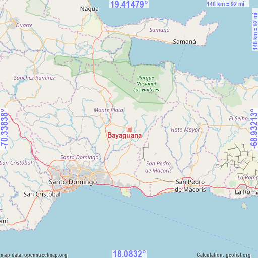
Bayaguana GPS coordinates[2]
18° 45' 1.116" North, 69° 38' 6.9" West
| Map corner | latitude | longitude |
|---|---|---|
| Upper-left | 19.41479°, | -70.33838° |
| Center: | 18.75031°, | -69.63525° |
| Lower-right: | 18.0832°, | -68.93213° |
| Map W x H: | 148.1×148.1 km | = 92×92mi |
| max Lat: | 19.89131° ⇑57.3% North |
| Bayaguana: | 18.75031° |
| min Lat: | ⇓42.7% South 17.80136° |
| min Long | Bayaguana | max Long |
| -71.85022° | -69.63525° | -68.40431° |
| W 89.1%⇐ | ⇒10.9% E |
Elevation
Elevation of Bayaguana is 59 m = 194 ft, and this is 107.3 m = 352 ft below average elevation for this country.
| Max E: |
1242 m = 4075 ft | 53.6% |
| Avg. | 166.3 m = 546 ft | |
| Bayaguana | 59 m = 194 ft | |
Min E: |
5 m = 16 ft | 46.4% |
See also: Dominican Republic elevation on elevation.city.
Geographical zone
Bayaguana is located in North Torrid zone (between Equator and Tropic of Cancer). Distance of this Northern Tropic circle is 521.1 km =323.8 mi to North.| Distance of | km | miles | from Bayaguana |
|---|---|---|---|
| North Pole | 7922.2 | 4922.6 | to North |
| Arctic Circle | 5316.3 | 3303.4 | to North |
| Tropic Cancer | 521.1 | 323.8 | to North |
| Equator | 2084.8 | 1295.4 | to South |


Nearby cities:
15 places around Bayaguana: (largest is in red/bold)
• Boca Chica
33.6 km =20.9 mi,  173°
173°
• Don Juan
33.9 km =21.1 mi,  284°
284°
• El Puerto
18.1 km =11.2 mi,  78°
78°
• El Valle
36.9 km =22.9 mi,  47°
47°
• Ensanche Luperón
39.4 km =24.5 mi,  225°
225°
• Gonzalo
25.5 km =15.8 mi,  331°
331°
• Guayabo Dulce
38.7 km =24 mi,  106°
106°
• Guerra
22.4 km =13.9 mi,  198°
198°
• Los Botados
38 km =23.6 mi,  266°
266°
• Los Llanos
20.6 km =12.8 mi,  134°
134°
• Majagual
38.7 km =24 mi, 326°
• Monte Plata
16.9 km =10.5 mi,  291°
291°
• Quisqueya
32.3 km =20.1 mi, 132°
• Sabana Grande de Boyá
27.3 km =17 mi,  322°
322°
• Santo Domingo Este
37.3 km =23.2 mi,  218°
218°
Sources, notices
• [Note1] Compared only with cities in Dominican Republic existing in our database
• [Src1] Map data: © OpenStreetMap contributors (CC-BY-SA)
• [Src2] Other city data from geonames.org with taken over terms of usage.
• [Src3] Geographical zone / Annual Mean Temperature by Robert A. Rohde @ Wikipedia
