Tissemsilt geodata
Tissemsilt is a seat of a first-order administrative division; located in Algeria in Africa/Algiers (GMT+1) time zone. With population of 61,155 people, there are 76 cities with bigger population in this country. Compared to other cities in Algeria, 64.7% of cities are located further ↑North; 72.1% of cities are located further →East and 79.8% of cities have lower elevation than Tissemsilt. Note1


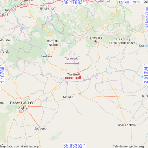
Tissemsilt GPS coordinates[2]
35° 36' 25.992" North, 1° 48' 38.916" East
| Map corner | latitude | longitude |
|---|---|---|
| Upper-left | 36.17683°, | 1.10769° |
| Center: | 35.60722°, | 1.81081° |
| Lower-right: | 35.03352°, | 2.51394° |
| Map W x H: | 127.1×127.1 km | = 79×79mi |
| max Lat: | 36.92917° ⇑64.7% North |
| Tissemsilt: | 35.60722° |
| min Lat: | ⇓35.3% South 22.785° |
| min Long | Tissemsilt | max Long |
| -8.14743° | 1.81081° | 8.46667° |
| W 27.9%⇐ | ⇒72.1% E |
Elevation
Elevation of Tissemsilt is 866 m = 2841 ft, and this is 427.5 m = 1403 ft above average elevation for this country.
| Max E: |
1392 m = 4567 ft | 20.2% |
| Tissemsilt | 866 m 2841 ft | |
| Avg. | 438.5 m = 1439 ft | |
Min E: |
5 m = 16 ft | 79.8% |
See also: Tissemsilt elevation on elevation.city.
Geographical zone
Tissemsilt is located in North temperate zone (between Tropic of Cancer and the Arctic Circle). Distance of this Northern Tropic circle is 1353.2 km =840.8 mi to South.| Distance of | km | miles | from Tissemsilt |
|---|---|---|---|
| North Pole | 6047.9 | 3758 | to North |
| Arctic Circle | 3442 | 2138.8 | to North |
| Tropic Cancer | 1353.2 | 840.8 | to South |
| Equator | 3959.2 | 2460.1 | to South |


Nearby cities:
15 places around Tissemsilt: (largest is in red/bold)
• Ammi Moussa
69.5 km =43.2 mi,  294°
294°
• Aïn Defla
74.4 km =46.2 mi,  10°
10°
• Boukadir
80.1 km =49.8 mi,  309°
309°
• Chlef
75.4 km =46.9 mi,  325°
325°
• Commune des Béni Bou Attab
46.5 km =28.9 mi,  337°
337°
• El Abadia
74.5 km =46.3 mi,  351°
351°
• El Attaf
69.7 km =43.3 mi, 349°
• Ksar Chellala
63.6 km =39.5 mi,  133°
133°
• Lardjem
28.5 km =17.7 mi,  303°
303°
• Mehdia daira de meghila
20.2 km =12.6 mi,  193°
193°
• Oued Fodda
68.9 km =42.8 mi, 338°
• Oued Sly
77.8 km =48.3 mi, 314°
• Sougueur
54.9 km =34.1 mi,  211°
211°
• Theniet el Had
35.3 km =21.9 mi,  33°
33°
• Tiaret
51.8 km =32.2 mi,  239°
239°
Sources, notices
• [Note1] Compared only with cities in Algeria existing in our database
• [Src1] Map data: © OpenStreetMap contributors (CC-BY-SA)
• [Src2] Other city data from geonames.org with taken over terms of usage.
• [Src3] Geographical zone / Annual Mean Temperature by Robert A. Rohde @ Wikipedia
