Mehdia daira de meghila geodata
Mehdia daira de meghila (Tiaret) is a populated place; located in Algeria in Africa/Algiers (GMT+1) time zone. With population of 39,271 people, there are 133 cities with bigger population in this country. Compared to other cities in Algeria, 69% of cities are located further ↑North; 72.5% of cities are located further →East and 83.7% of cities have lower elevation than Mehdia daira de meghila. Note1
Current local time in Mehdia daira de meghila:
03:45 AM, WednesdayDifference from your time zone: hours


Mehdia daira de meghila GPS coordinates[2]
35° 25' 50.088" North, 1° 45' 25.704" East
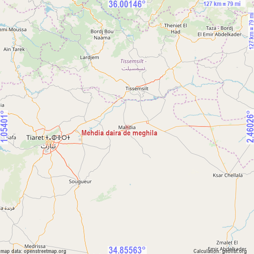
| Map corner | latitude | longitude |
|---|---|---|
| Upper-left | 36.00146°, | 1.05401° |
| Center: | 35.43058°, | 1.75714° |
| Lower-right: | 34.85563°, | 2.46026° |
| Map W x H: | 127.4×127.4 km | = 79.2×79.2mi |
| max Lat: | 36.92917° ⇑69% North |
| Mehdia daira de meghila: | 35.43058° |
| min Lat: | ⇓31% South 22.785° |
| min Long | Mehdia daira de | max Long |
| -8.14743° | 1.75714° | 8.46667° |
| W 27.5%⇐ | ⇒72.5% E |
Elevation
Elevation of Mehdia daira de meghila is 909 m = 2982 ft, and this is 470.5 m = 1544 ft above average elevation for this country.
| Max E: |
1392 m = 4567 ft | 16.3% |
| Mehdia daira de meghila | 909 m 2982 ft | |
| Avg. | 438.5 m = 1439 ft | |
Min E: |
5 m = 16 ft | 83.7% |
See also: Algeria elevation on elevation.city.
Geographical zone
Mehdia daira de meghila is located in North temperate zone (between Tropic of Cancer and the Arctic Circle). Distance of this Northern Tropic circle is 1333.6 km =828.7 mi to South.| Distance of | km | miles | from Mehdia daira de meghila |
|---|---|---|---|
| North Pole | 6067.6 | 3770.2 | to North |
| Arctic Circle | 3461.7 | 2151 | to North |
| Tropic Cancer | 1333.6 | 828.7 | to South |
| Equator | 3939.5 | 2447.9 | to South |


Nearby cities:
15 places around Mehdia daira de meghila: (largest is in red/bold)
• Ammi Moussa
75.9 km =47.2 mi,  309°
309°
• Boukadir
90.8 km =56.4 mi,  321°
321°
• Chlef
90.1 km =56 mi,  334°
334°
• Commune des Béni Bou Attab
64 km =39.8 mi,  348°
348°
• El Attaf
88.5 km =55 mi,  355°
355°
• Frenda
76 km =47.2 mi,  237°
237°
• Ksar Chellala
56.5 km =35.1 mi,  115°
115°
• Lardjem
40.2 km =25 mi, 331°
• Oued Fodda
86.3 km =53.6 mi, 346°
• Oued Sly
90 km =55.9 mi, 325°
• Sougueur
36.1 km =22.4 mi,  221°
221°
• Theniet el Had
54.8 km =34.1 mi,  26°
26°
• Tiaret
40.4 km =25.1 mi,  260°
260°
• Tissemsilt
20.2 km =12.6 mi,  13°
13°
• ’Aïn Deheb
68.2 km =42.4 mi,  196°
196°
Sources, notices
• [Note1] Compared only with cities in Algeria existing in our database
• [Src1] Map data: © OpenStreetMap contributors (CC-BY-SA)
• [Src2] Other city data from geonames.org with taken over terms of usage.
• [Src3] Geographical zone / Annual Mean Temperature by Robert A. Rohde @ Wikipedia
