Reghaïa geodata
Reghaïa (Boumerdes) is a populated place; located in Algeria in Africa/Algiers (GMT+1) time zone. With population of 54,962 people, there are 87 cities with bigger population in this country. Compared to other cities in Algeria, 89.5% of cities are located further ↓South; 52.3% of cities are located further →East and 97.7% of cities have higher elevation than Reghaïa. Note1


Reghaïa GPS coordinates[2]
36° 44' 9.132" North, 3° 20' 24.648" East
| Map corner | latitude | longitude |
|---|---|---|
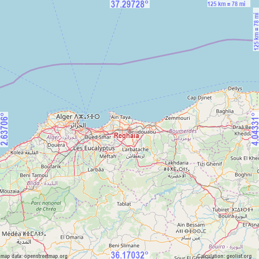
| Upper-left | 37.29728°, | 2.63706° |
| Center: | 36.73587°, | 3.34018° |
| Lower-right: | 36.17032°, | 4.04331° |
| Map W x H: | 125.3×125.3 km | = 77.9×77.9mi |
| max Lat: | 36.92917° ⇑10.5% North |
| Reghaïa: | 36.73587° |
| min Lat: | ⇓89.5% South 22.785° |
| min Long | Reghaïa | max Long |
| -8.14743° | 3.34018° | 8.46667° |
| W 47.7%⇐ | ⇒52.3% E |
Elevation
Elevation of Reghaïa is 14 m = 46 ft, and this is 424.5 m = 1393 ft below average elevation for this country.
| Max E: |
1392 m = 4567 ft | 97.7% |
| Avg. | 438.5 m = 1439 ft | |
| Reghaïa | 14 m = 46 ft | |
Min E: |
5 m = 16 ft | 2.3% |
See also: Reghaïa elevation on elevation.city.
Geographical zone
Reghaïa is located in North temperate zone (between Tropic of Cancer and the Arctic Circle). Distance of this Northern Tropic circle is 1478.7 km =918.8 mi to South.| Distance of | km | miles | from Reghaïa |
|---|---|---|---|
| North Pole | 5922.4 | 3680 | to North |
| Arctic Circle | 3316.5 | 2060.8 | to North |
| Tropic Cancer | 1478.7 | 918.8 | to South |
| Equator | 4084.6 | 2538.1 | to South |


Nearby cities:
15 places around Reghaïa: (largest is in red/bold)
• Algiers
22.5 km =14 mi,  268°
268°
• Arbatache
11.3 km =7 mi,  165°
165°
• Aïn Taya
8 km =5 mi,  323°
323°
• Bab Ezzouar
14.1 km =8.8 mi, 265°
• Baraki
23.1 km =14.4 mi,  250°
250°
• Beni Amrane
23.6 km =14.7 mi,  108°
108°
• Bordj el Kiffan
13.2 km =8.2 mi,  276°
276°
• Boudouaou
6.3 km =3.9 mi,  98°
98°
• Boumerdas
12.7 km =7.9 mi,  74°
74°
• Dar el Beïda
11.7 km =7.3 mi,  257°
257°
• Khemis el Khechna
9.6 km =6 mi,  185°
185°
• Meftah
16.6 km =10.3 mi,  219°
219°
• Ouled Moussa
6.2 km =3.9 mi,  157°
157°
• Rouiba
5.3 km =3.3 mi, 272°
• Thenia
19.3 km =12 mi,  93°
93°
Sources, notices
• [Note1] Compared only with cities in Algeria existing in our database
• [Src1] Map data: © OpenStreetMap contributors (CC-BY-SA)
• [Src2] Other city data from geonames.org with taken over terms of usage.
• [Src3] Geographical zone / Annual Mean Temperature by Robert A. Rohde @ Wikipedia
