Ksar el Boukhari geodata
Ksar el Boukhari (Medea) is a populated place; located in Algeria in Africa/Algiers (GMT+1) time zone. With population of 77,166 people, there are 50 cities with bigger population in this country. Compared to other cities in Algeria, 54.7% of cities are located further ↑North; 66.7% of cities are located further →East and 67.1% of cities have lower elevation than Ksar el Boukhari. Note1


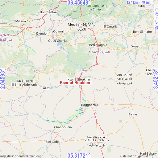
Ksar el Boukhari GPS coordinates[2]
35° 53' 20.004" North, 2° 44' 56.58" East
| Map corner | latitude | longitude |
|---|---|---|
| Upper-left | 36.45648°, | 2.04593° |
| Center: | 35.88889°, | 2.74905° |
| Lower-right: | 35.31721°, | 3.45218° |
| Map W x H: | 126.7×126.7 km | = 78.7×78.7mi |
| max Lat: | 36.92917° ⇑54.7% North |
| Ksar el Boukhari: | 35.88889° |
| min Lat: | ⇓45.3% South 22.785° |
| min Long | Ksar el Boukhar | max Long |
| -8.14743° | 2.74905° | 8.46667° |
| W 33.3%⇐ | ⇒66.7% E |
Elevation
Elevation of Ksar el Boukhari is 621 m = 2037 ft, and this is 182.5 m = 599 ft above average elevation for this country.
| Max E: |
1392 m = 4567 ft | 32.9% |
| Ksar el Boukhari | 621 m 2037 ft | |
| Avg. | 438.5 m = 1439 ft | |
Min E: |
5 m = 16 ft | 67.1% |
See also: Ksar el Boukhari elevation on elevation.city.
Geographical zone
Ksar el Boukhari is located in North temperate zone (between Tropic of Cancer and the Arctic Circle). Distance of this Northern Tropic circle is 1384.6 km =860.4 mi to South.| Distance of | km | miles | from Ksar el Boukhari |
|---|---|---|---|
| North Pole | 6016.6 | 3738.5 | to North |
| Arctic Circle | 3410.7 | 2119.3 | to North |
| Tropic Cancer | 1384.6 | 860.4 | to South |
| Equator | 3990.5 | 2479.6 | to South |


Nearby cities:
15 places around Ksar el Boukhari: (largest is in red/bold)
• Aïn Oussera
50.7 km =31.5 mi,  163°
163°
• Beni Mered
71.3 km =44.3 mi,  8°
8°
• Berrouaghia
31 km =19.3 mi,  27°
27°
• Birine
51.4 km =31.9 mi,  123°
123°
• Blida
65 km =40.4 mi, 6°
• Boû Arfa
64.1 km =39.8 mi, 5°
• Chiffa
63.8 km =39.6 mi,  359°
359°
• El Affroun
65.6 km =40.8 mi,  350°
350°
• Khemis Miliana
63 km =39.1 mi,  311°
311°
• Mouzaïa
64.5 km =40.1 mi, 355°
• Médéa
41.7 km =25.9 mi,  0°
0°
• Oued el Alleug
74.2 km =46.1 mi, 2°
• Souma
71.4 km =44.4 mi, 11°
• Theniet el Had
65 km =40.4 mi,  268°
268°
• ’Aïn Boucif
36.9 km =22.9 mi,  89°
89°
Sources, notices
• [Note1] Compared only with cities in Algeria existing in our database
• [Src1] Map data: © OpenStreetMap contributors (CC-BY-SA)
• [Src2] Other city data from geonames.org with taken over terms of usage.
• [Src3] Geographical zone / Annual Mean Temperature by Robert A. Rohde @ Wikipedia
