Beni Mester geodata
Beni Mester (Tlemcen) is a populated place; located in Algeria in Africa/Algiers (GMT+1) time zone. With population of 19,808 people, there are 231 cities with bigger population in this country. Compared to other cities in Algeria, 80.2% of cities are located further ↑North; 98.4% of cities are located further →East and 70.9% of cities have lower elevation than Beni Mester. Note1


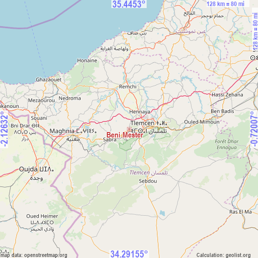
Beni Mester GPS coordinates[2]
34° 52' 13.62" North, 1° 25' 23.484" West
| Map corner | latitude | longitude |
|---|---|---|
| Upper-left | 35.4453°, | -2.12632° |
| Center: | 34.87045°, | -1.42319° |
| Lower-right: | 34.29155°, | -0.72007° |
| Map W x H: | 128.3×128.3 km | = 79.7×79.7mi |
| max Lat: | 36.92917° ⇑80.2% North |
| Beni Mester: | 34.87045° |
| min Lat: | ⇓19.8% South 22.785° |
| min Long | Beni Mester | max Long |
| -8.14743° | -1.42319° | 8.46667° |
| W 1.6%⇐ | ⇒98.4% E |
Elevation
Elevation of Beni Mester is 683 m = 2241 ft, and this is 244.5 m = 802 ft above average elevation for this country.
| Max E: |
1392 m = 4567 ft | 29.1% |
| Beni Mester | 683 m 2241 ft | |
| Avg. | 438.5 m = 1439 ft | |
Min E: |
5 m = 16 ft | 70.9% |
See also: Algeria elevation on elevation.city.
Geographical zone
Beni Mester is located in North temperate zone (between Tropic of Cancer and the Arctic Circle). Distance of this Northern Tropic circle is 1271.3 km =789.9 mi to South.| Distance of | km | miles | from Beni Mester |
|---|---|---|---|
| North Pole | 6129.8 | 3808.9 | to North |
| Arctic Circle | 3523.9 | 2189.6 | to North |
| Tropic Cancer | 1271.3 | 789.9 | to South |
| Equator | 3877.2 | 2409.2 | to South |


Nearby cities:
15 places around Beni Mester: (largest is in red/bold)
• Aïn Temouchent
54 km =33.6 mi,  28°
28°
• Beni Saf
48 km =29.8 mi,  4°
4°
• Bensekrane
29 km =18 mi,  38°
38°
• Chetouane
13 km =8.1 mi,  64°
64°
• El Malah
65.3 km =40.6 mi, 27°
• Hammam Bou Hadjar
70.1 km =43.6 mi, 36°
• Hennaya
10.3 km =6.4 mi, 29°
• Mansoûra
7.7 km =4.8 mi,  97°
97°
• Nedroma
33.6 km =20.9 mi,  298°
298°
• Ouled Mimoun
35.7 km =22.2 mi,  83°
83°
• Remchi
21.3 km =13.2 mi,  357°
357°
• Sebdou
27.3 km =17 mi,  162°
162°
• Sidi Abdelli
34.2 km =21.3 mi,  49°
49°
• Sidi Senoussi سيدي سنوسي
33.1 km =20.6 mi, 64°
• Tlemcen
9.9 km =6.2 mi, 84°
Sources, notices
• [Note1] Compared only with cities in Algeria existing in our database
• [Src1] Map data: © OpenStreetMap contributors (CC-BY-SA)
• [Src2] Other city data from geonames.org with taken over terms of usage.
• [Src3] Geographical zone / Annual Mean Temperature by Robert A. Rohde @ Wikipedia
