Latacunga geodata
Latacunga (Cotopaxi) is a seat of a first-order administrative division; located in Ecuador in America/Guayaquil (GMT-5) time zone. With population of 51,717 people, there are 19 cities with bigger population in this country. Compared to other cities in Ecuador, 68.6% of cities are located further ↓South; 73.6% of cities are located further ←West and 89.3% of cities have lower elevation than Latacunga. Note1


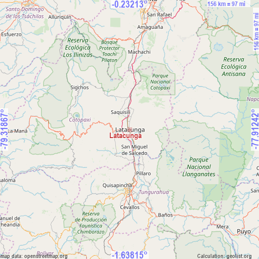
Latacunga GPS coordinates[2]
0° 56' 6.756" South, 78° 36' 55.944" West
| Map corner | latitude | longitude |
|---|---|---|
| Upper-left | -0.23213°, | -79.31867° |
| Center: | -0.93521°, | -78.61554° |
| Lower-right: | -1.63815°, | -77.91242° |
| Map W x H: | 156.3×156.3 km | = 97.1×97.1mi |
| max Lat: | 1.35251° ⇑31.4% North |
| Latacunga: | -0.93521° |
| min Lat: | ⇓68.6% South -4.38181° |
| min Long | Latacunga | max Long |
| -90.96654° | -78.61554° | -76.89528° |
| W 73.6%⇐ | ⇒26.4% E |
Elevation
Elevation of Latacunga is 2769 m = 9085 ft, and this is 1823.9 m = 5984 ft above average elevation for this country.
| Max E: |
3131 m = 10272 ft | 10.7% |
| Latacunga | 2769 m 9085 ft | |
| Avg. | 945.1 m = 3101 ft | |
Min E: |
1 m = 3 ft | 89.3% |
See also: Latacunga elevation on elevation.city.
Geographical zone
Latacunga is located in South Torrid zone (between Equator and Tropic of Capricorn). Distance of Equator is 104 km =64.6 mi to North.| Distance of | km | miles | from Latacunga |
|---|---|---|---|
| Equator | 104 | 64.6 | to North |
| Tropic Capricorn | 2501.9 | 1554.6 | to South |
| Antarctic Circle | 7297.2 | 4534.3 | to South |
| South Pole | 9903.1 | 6153.5 | to South |


Nearby cities:
15 places around Latacunga: (largest is in red/bold)
• Ambato
34.9 km =21.7 mi,  180°
180°
• Baños
55.6 km =34.5 mi,  157°
157°
• Guano
74.8 km =46.5 mi, 181°
• La Maná
67.8 km =42.1 mi,  269°
269°
• Machachi
47.6 km =29.6 mi,  6°
6°
• Pelileo
44.6 km =27.7 mi,  169°
169°
• Pujilí
9.3 km =5.8 mi,  254°
254°
• Píllaro
27.6 km =17.1 mi, 163°
• Quero
49.6 km =30.8 mi, 179°
• Quito
79.1 km =49.2 mi, 7°
• Riobamba
81.9 km =50.9 mi, 182°
• San Miguel de Salcedo
12.6 km =7.8 mi, 167°
• Sangolquí
69.3 km =43.1 mi,  15°
15°
• Saquisilí
12 km =7.5 mi,  331°
331°
• Tutamandahostel
83.1 km =51.6 mi, 9°
Sources, notices
• [Note1] Compared only with cities in Ecuador existing in our database
• [Src1] Map data: © OpenStreetMap contributors (CC-BY-SA)
• [Src2] Other city data from geonames.org with taken over terms of usage.
• [Src3] Geographical zone / Annual Mean Temperature by Robert A. Rohde @ Wikipedia
