Riobamba geodata
Riobamba (Chimborazo) is a seat of a first-order administrative division; located in Ecuador in America/Guayaquil (GMT-5) time zone. With population of 124,478 people, there are 13 cities with bigger population in this country. Compared to other cities in Ecuador, 56.2% of cities are located further ↑North; 71.1% of cities are located further ←West and 88.4% of cities have lower elevation than Riobamba. Note1


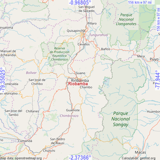
Riobamba GPS coordinates[2]
1° 40' 15.528" South, 78° 38' 49.632" West
| Map corner | latitude | longitude |
|---|---|---|
| Upper-left | -0.96805°, | -79.35025° |
| Center: | -1.67098°, | -78.64712° |
| Lower-right: | -2.37366°, | -77.944° |
| Map W x H: | 156.3×156.3 km | = 97.1×97.1mi |
| max Lat: | 1.35251° ⇑56.2% North |
| Riobamba: | -1.67098° |
| min Lat: | ⇓43.8% South -4.38181° |
| min Long | Riobamba | max Long |
| -90.96654° | -78.64712° | -76.89528° |
| W 71.1%⇐ | ⇒28.9% E |
Elevation
Elevation of Riobamba is 2758 m = 9049 ft, and this is 1812.9 m = 5948 ft above average elevation for this country.
| Max E: |
3131 m = 10272 ft | 11.6% |
| Riobamba | 2758 m 9049 ft | |
| Avg. | 945.1 m = 3101 ft | |
Min E: |
1 m = 3 ft | 88.4% |
See also: Riobamba elevation on elevation.city.
Geographical zone
Riobamba is located in South Torrid zone (between Equator and Tropic of Capricorn). Distance of Equator is 185.8 km =115.5 mi to North.| Distance of | km | miles | from Riobamba |
|---|---|---|---|
| Equator | 185.8 | 115.5 | to North |
| Tropic Capricorn | 2420.1 | 1503.8 | to South |
| Antarctic Circle | 7215.4 | 4483.4 | to South |
| South Pole | 9821.3 | 6102.7 | to South |


Nearby cities:
15 places around Riobamba: (largest is in red/bold)
• Alausí
63.2 km =39.3 mi,  200°
200°
• Ambato
47 km =29.2 mi,  4°
4°
• Baños
39.4 km =24.5 mi,  39°
39°
• Guano
7.2 km =4.5 mi,  14°
14°
• Guaranda
40.3 km =25 mi,  282°
282°
• Latacunga
81.9 km =50.9 mi, 2°
• Montalvo
72.4 km =45 mi,  259°
259°
• Palora
75.9 km =47.2 mi,  92°
92°
• Pelileo
39.6 km =24.6 mi,  16°
16°
• Pujilí
79.5 km =49.4 mi,  356°
356°
• Puyo
74.6 km =46.4 mi,  73°
73°
• Píllaro
56.4 km =35 mi, 11°
• Quero
32.5 km =20.2 mi, 7°
• San Miguel
44.2 km =27.5 mi, 264°
• San Miguel de Salcedo
69.8 km =43.4 mi, 5°
Sources, notices
• [Note1] Compared only with cities in Ecuador existing in our database
• [Src1] Map data: © OpenStreetMap contributors (CC-BY-SA)
• [Src2] Other city data from geonames.org with taken over terms of usage.
• [Src3] Geographical zone / Annual Mean Temperature by Robert A. Rohde @ Wikipedia
