Qaşr al Farāfirah geodata
Qaşr al Farāfirah (New Valley) is a populated place; located in Egypt in Africa/Cairo (GMT+2) time zone. With population of 5,000 people, there are 128 cities with bigger population in this country. Compared to other cities in Egypt, 81.9% of cities are located further ↑North; 98.6% of cities are located further →East and 88.4% of cities have lower elevation than Qaşr al Farāfirah. Note1


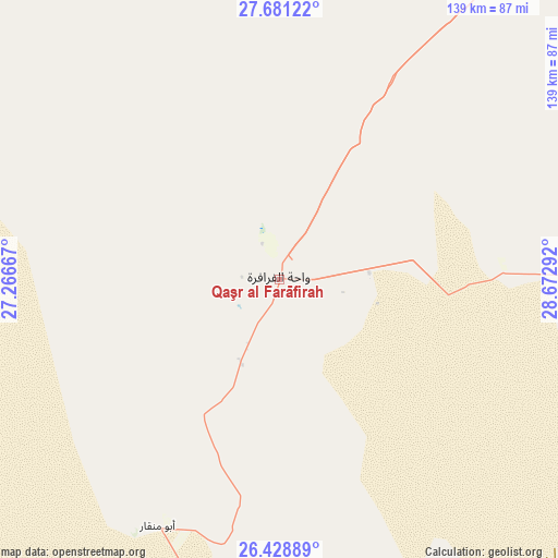
Qaşr al Farāfirah GPS coordinates[2]
27° 3' 24.48" North, 27° 58' 11.244" East
| Map corner | latitude | longitude |
|---|---|---|
| Upper-left | 27.68122°, | 27.26667° |
| Center: | 27.0568°, | 27.96979° |
| Lower-right: | 26.42889°, | 28.67292° |
| Map W x H: | 139.2×139.2 km | = 86.5×86.5mi |
| max Lat: | 31.5084° ⇑81.9% North |
| Qaşr al Farāfirah: | 27.0568° |
| min Lat: | ⇓18.1% South 22.3457° |
| min Long | Qaşr al Farāf | max Long |
| 25.51965° | 27.96979° | 34.89572° |
| W 1.4%⇐ | ⇒98.6% E |
Elevation
Elevation of Qaşr al Farāfirah is 76 m = 249 ft, and this is 32.5 m = 107 ft above average elevation for this country.
| Max E: |
1565 m = 5135 ft | 11.6% |
| Qaşr al Farāfirah | 76 m 249 ft | |
| Avg. | 43.5 m = 143 ft | |
Min E: |
-15 m = -49 ft | 88.4% |
See also: Egypt elevation on elevation.city.
Geographical zone
Qaşr al Farāfirah is located in North temperate zone (between Tropic of Cancer and the Arctic Circle). Distance of this Northern Tropic circle is 402.5 km =250.1 mi to South.| Distance of | km | miles | from Qaşr al Farāfirah |
|---|---|---|---|
| North Pole | 6998.6 | 4348.7 | to North |
| Arctic Circle | 4392.7 | 2729.5 | to North |
| Tropic Cancer | 402.5 | 250.1 | to South |
| Equator | 3008.4 | 1869.3 | to South |


Nearby cities:
15 places around Qaşr al Farāfirah: (largest is in red/bold)
• Abnūb
315.6 km =196.1 mi,  85°
85°
• Abū Qurqāş
299.2 km =185.9 mi,  71°
71°
• Abū Tīj
331.6 km =206 mi, 90°
• Al Bawīţī
168.6 km =104.8 mi,  31°
31°
• Al Khārijah
312.8 km =194.4 mi,  124°
124°
• Al Minyā
298 km =185.2 mi, 66°
• Al Qūşīyah
284.8 km =177 mi,  81°
81°
• Asyūţ
318.4 km =197.8 mi, 87°
• Banī Mazār
321.6 km =199.8 mi,  59°
59°
• Dayr Mawās
291.5 km =181.1 mi, 77°
• Dayrūţ
285.8 km =177.6 mi, 78°
• Mallawī
293.3 km =182.2 mi, 75°
• Manfalūţ
298.1 km =185.2 mi, 84°
• Maţāy
315.2 km =195.9 mi, 61°
• Samālūţ
303.8 km =188.8 mi, 62°
Sources, notices
• [Note1] Compared only with cities in Egypt existing in our database
• [Src1] Map data: © OpenStreetMap contributors (CC-BY-SA)
• [Src2] Other city data from geonames.org with taken over terms of usage.
• [Src3] Geographical zone / Annual Mean Temperature by Robert A. Rohde @ Wikipedia
