Al Khārijah geodata
Al Khārijah (New Valley) is a seat of a first-order administrative division; located in Egypt in Africa/Cairo (GMT+2) time zone. With population of 67,700 people, there are 57 cities with bigger population in this country. Compared to other cities in Egypt, 95.7% of cities are located further ↑North; 89.9% of cities are located further →East and 92% of cities have lower elevation than Al Khārijah. Note1


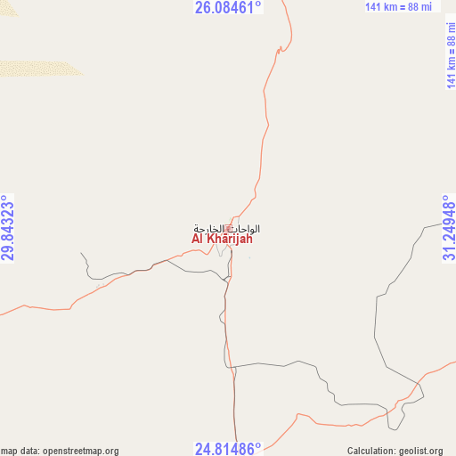
Al Khārijah GPS coordinates[2]
25° 27' 5.076" North, 30° 32' 46.86" East
| Map corner | latitude | longitude |
|---|---|---|
| Upper-left | 26.08461°, | 29.84323° |
| Center: | 25.45141°, | 30.54635° |
| Lower-right: | 24.81486°, | 31.24948° |
| Map W x H: | 141.2×141.2 km | = 87.7×87.7mi |
| max Lat: | 31.5084° ⇑95.7% North |
| Al Khārijah: | 25.45141° |
| min Lat: | ⇓4.3% South 22.3457° |
| min Long | Al Khārijah | max Long |
| 25.51965° | 30.54635° | 34.89572° |
| W 10.1%⇐ | ⇒89.9% E |
Elevation
Elevation of Al Khārijah is 81 m = 266 ft, and this is 37.5 m = 123 ft above average elevation for this country.
| Max E: |
1565 m = 5135 ft | 8% |
| Al Khārijah | 81 m 266 ft | |
| Avg. | 43.5 m = 143 ft | |
Min E: |
-15 m = -49 ft | 92% |
See also: Al Khārijah elevation on elevation.city.
Geographical zone
Al Khārijah is located in North temperate zone (between Tropic of Cancer and the Arctic Circle). Distance of this Northern Tropic circle is 224 km =139.2 mi to South.| Distance of | km | miles | from Al Khārijah |
|---|---|---|---|
| North Pole | 7177.1 | 4459.6 | to North |
| Arctic Circle | 4571.2 | 2840.4 | to North |
| Tropic Cancer | 224 | 139.2 | to South |
| Equator | 2829.9 | 1758.4 | to South |


Nearby cities:
15 places around Al Khārijah: (largest is in red/bold)
• Abnūb
210.9 km =131 mi,  16°
16°
• Abū Tīj
193.1 km =120 mi, 23°
• Akhmīm
172 km =106.9 mi,  44°
44°
• Al Badārī
192 km =119.3 mi,  26°
26°
• Al Balyanā
169.9 km =105.6 mi,  59°
59°
• Al Manshāh
169.7 km =105.4 mi,  47°
47°
• Asyūţ
202.5 km =125.8 mi, 18°
• Dishnā
207.2 km =128.7 mi,  68°
68°
• Farshūţ
175.3 km =108.9 mi, 67°
• Isnā
202.5 km =125.8 mi,  94°
94°
• Jirjā
166.8 km =103.6 mi, 53°
• Juhaynah
165.8 km =103 mi, 34°
• Naja' Ḥammādī
182.3 km =113.3 mi, 68°
• Sohag
168.2 km =104.5 mi, 43°
• Ţahţā
174.9 km =108.7 mi, 33°
Sources, notices
• [Note1] Compared only with cities in Egypt existing in our database
• [Src1] Map data: © OpenStreetMap contributors (CC-BY-SA)
• [Src2] Other city data from geonames.org with taken over terms of usage.
• [Src3] Geographical zone / Annual Mean Temperature by Robert A. Rohde @ Wikipedia
