Al Manzalah geodata
Al Manzalah (Dakahlia) is a populated place; located in Egypt in Africa/Cairo (GMT+2) time zone. With population of 67,486 people, there are 59 cities with bigger population in this country. Compared to other cities in Egypt, 87% of cities are located further ↓South; 76.1% of cities are located further ←West and 86.2% of cities have higher elevation than Al Manzalah. Note1


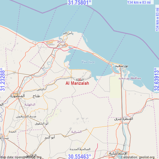
Al Manzalah GPS coordinates[2]
31° 9' 29.628" North, 31° 56' 9.6" East
| Map corner | latitude | longitude |
|---|---|---|
| Upper-left | 31.75801°, | 31.23288° |
| Center: | 31.15823°, | 31.936° |
| Lower-right: | 30.55463°, | 32.63913° |
| Map W x H: | 133.8×133.8 km | = 83.1×83.1mi |
| max Lat: | 31.5084° ⇑13% North |
| Al Manzalah: | 31.15823° |
| min Lat: | ⇓87% South 22.3457° |
| min Long | Al Manzalah | max Long |
| 25.51965° | 31.936° | 34.89572° |
| W 76.1%⇐ | ⇒23.9% E |
Elevation
Elevation of Al Manzalah is 9 m = 30 ft, and this is 34.5 m = 113 ft below average elevation for this country.
| Max E: |
1565 m = 5135 ft | 86.2% |
| Avg. | 43.5 m = 143 ft | |
| Al Manzalah | 9 m = 30 ft | |
Min E: |
-15 m = -49 ft | 13.8% |
See also: Al Manzalah elevation on elevation.city.
Geographical zone
Al Manzalah is located in North temperate zone (between Tropic of Cancer and the Arctic Circle). Distance of this Northern Tropic circle is 858.6 km =533.5 mi to South.| Distance of | km | miles | from Al Manzalah |
|---|---|---|---|
| North Pole | 6542.6 | 4065.4 | to North |
| Arctic Circle | 3936.7 | 2446.2 | to North |
| Tropic Cancer | 858.6 | 533.5 | to South |
| Equator | 3464.5 | 2152.7 | to South |


Nearby cities:
15 places around Al Manzalah: (largest is in red/bold)
• Abū Kabīr
54.4 km =33.8 mi,  207°
207°
• Al Jammālīyah
7.2 km =4.5 mi,  290°
290°
• Al Manşūrah
54.6 km =33.9 mi,  255°
255°
• Al Maţarīyah
9.5 km =5.9 mi,  73°
73°
• Az Zarqā
29.1 km =18.1 mi,  281°
281°
• Damietta
31 km =19.3 mi,  337°
337°
• Dikirnis
33.4 km =20.8 mi, 256°
• Fāqūs
49.6 km =30.8 mi,  195°
195°
• Fāraskūr
28.4 km =17.6 mi,  312°
312°
• Kafr Şaqr
50.2 km =31.2 mi,  216°
216°
• Minyat an Naşr
28.1 km =17.5 mi, 262°
• Port Said
34.9 km =21.7 mi, 71°
• Shirbīn
39.4 km =24.5 mi, 276°
• Ţalkhā
54.4 km =33.8 mi, 257°
• ‘Izbat al Burj
40 km =24.9 mi,  346°
346°
Sources, notices
• [Note1] Compared only with cities in Egypt existing in our database
• [Src1] Map data: © OpenStreetMap contributors (CC-BY-SA)
• [Src2] Other city data from geonames.org with taken over terms of usage.
• [Src3] Geographical zone / Annual Mean Temperature by Robert A. Rohde @ Wikipedia
