Villaviciosa de Córdoba geodata
Villaviciosa de Córdoba (Andalusia) is a populated place; located in Spain in Europe/Madrid (GMT+2) time zone. With population of 3,647 people, there are 1552 cities with bigger population in this country. Compared to other cities in Spain, 88% of cities are located further ↑North; 72.7% of cities are located further →East and 53.1% of cities have lower elevation than Villaviciosa de Córdoba. Note1
Current local time in Villaviciosa de Córdoba:
09:16 PM, ThursdayDifference from your time zone: hours


Villaviciosa de Córdoba GPS coordinates[2]
38° 4' 59.988" North, 5° 1' 0.012" West
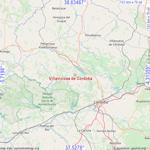
| Map corner | latitude | longitude |
|---|---|---|
| Upper-left | 38.63467°, | -5.7198° |
| Center: | 38.08333°, | -5.01667° |
| Lower-right: | 37.5278°, | -4.31355° |
| Map W x H: | 123.1×123.1 km | = 76.5×76.5mi |
| max Lat: | 43.74134° ⇑88% North |
| Villaviciosa de Córdoba: | 38.08333° |
| min Lat: | ⇓12% South 27.64134° |
| min Long | Villaviciosa de | max Long |
| -18.00367° | -5.01667° | 4.2899° |
| W 27.3%⇐ | ⇒72.7% E |
Elevation
Elevation of Villaviciosa de Córdoba is 692 m = 2270 ft, and this is 94 m = 308 ft above average elevation for this country.
| Max E: |
1682 m = 5518 ft | 46.9% |
| Villaviciosa de Córdoba | 692 m 2270 ft | |
| Avg. | 598 m = 1962 ft | |
Min E: |
0 m = 0 ft | 53.1% |
See also: Spain elevation on elevation.city.
Geographical zone
Villaviciosa de Córdoba is located in North temperate zone (between Tropic of Cancer and the Arctic Circle). Distance of this Northern Tropic circle is 1628.6 km =1012 mi to South.| Distance of | km | miles | from Villaviciosa de Córdoba |
|---|---|---|---|
| North Pole | 5772.6 | 3586.9 | to North |
| Arctic Circle | 3166.7 | 1967.7 | to North |
| Tropic Cancer | 1628.6 | 1012 | to South |
| Equator | 4234.5 | 2631.2 | to South |


Nearby cities:
15 places around Villaviciosa de Córdoba: (largest is in red/bold)
• Alcaracejos
33.6 km =20.9 mi,  7°
7°
• Almodóvar del Río
30.3 km =18.8 mi,  180°
180°
• Bélmez
25.9 km =16.1 mi,  321°
321°
• Córdoba
30.2 km =18.8 mi,  134°
134°
• Espiel
13 km =8.1 mi,  0°
0°
• Fuente la Lancha
37.1 km =23.1 mi,  357°
357°
• Guadalcázar
36.8 km =22.9 mi,  170°
170°
• Hornachuelos
33.7 km =20.9 mi,  214°
214°
• Obejo
19.7 km =12.2 mi,  73°
73°
• Peñarroya-Pueblonuevo
32.5 km =20.2 mi, 317°
• Posadas
32.3 km =20.1 mi,  194°
194°
• Pozoblanco
36 km =22.4 mi,  24°
24°
• Villaharta
11.6 km =7.2 mi,  61°
61°
• Villanueva del Duque
33.4 km =20.8 mi, 2°
• Villarrubia
27.9 km =17.3 mi,  158°
158°
Sources, notices
• [Note1] Compared only with cities in Spain existing in our database
• [Src1] Map data: © OpenStreetMap contributors (CC-BY-SA)
• [Src2] Other city data from geonames.org with taken over terms of usage.
• [Src3] Geographical zone / Annual Mean Temperature by Robert A. Rohde @ Wikipedia
