Guadalcázar geodata
Guadalcázar (Andalusia) is a seat of a third-order administrative division; located in Spain in Europe/Madrid (GMT+2) time zone. With population of 1,234 people, there are 2699 cities with bigger population in this country. Compared to other cities in Spain, 89.8% of cities are located further ↑North; 71.7% of cities are located further →East and 83.5% of cities have higher elevation than Guadalcázar. Note1


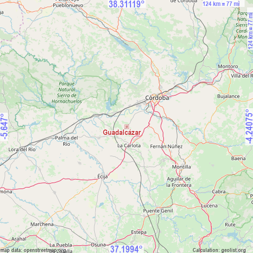
Guadalcázar GPS coordinates[2]
37° 45' 26.568" North, 4° 56' 37.932" West
| Map corner | latitude | longitude |
|---|---|---|
| Upper-left | 38.31119°, | -5.647° |
| Center: | 37.75738°, | -4.94387° |
| Lower-right: | 37.1994°, | -4.24075° |
| Map W x H: | 123.6×123.6 km | = 76.8×76.8mi |
| max Lat: | 43.74134° ⇑89.8% North |
| Guadalcázar: | 37.75738° |
| min Lat: | ⇓10.2% South 27.64134° |
| min Long | Guadalcázar | max Long |
| -18.00367° | -4.94387° | 4.2899° |
| W 28.3%⇐ | ⇒71.7% E |
Elevation
Elevation of Guadalcázar is 162 m = 531 ft, and this is 436 m = 1430 ft below average elevation for this country.
| Max E: |
1682 m = 5518 ft | 83.5% |
| Avg. | 598 m = 1962 ft | |
| Guadalcázar | 162 m = 531 ft | |
Min E: |
0 m = 0 ft | 16.5% |
See also: Spain elevation on elevation.city.
Geographical zone
Guadalcázar is located in North temperate zone (between Tropic of Cancer and the Arctic Circle). Distance of this Northern Tropic circle is 1592.3 km =989.4 mi to South.| Distance of | km | miles | from Guadalcázar |
|---|---|---|---|
| North Pole | 5808.8 | 3609.4 | to North |
| Arctic Circle | 3202.9 | 1990.2 | to North |
| Tropic Cancer | 1592.3 | 989.4 | to South |
| Equator | 4198.2 | 2608.6 | to South |


Nearby cities:
15 places around Guadalcázar: (largest is in red/bold)
• Almodóvar del Río
9 km =5.6 mi,  311°
311°
• Córdoba
21.2 km =13.2 mi,  45°
45°
• Fernán-Núñez
21.4 km =13.3 mi,  116°
116°
• Fuente Palmera
14.9 km =9.3 mi,  246°
246°
• Hornachuelos
26.8 km =16.7 mi,  288°
288°
• La Carlota
9.4 km =5.8 mi,  173°
173°
• La Rambla
24.5 km =15.2 mi,  132°
132°
• La Victoria
11.7 km =7.3 mi,  136°
136°
• Montalbán de Córdoba
26.1 km =16.2 mi, 139°
• Montemayor
24.8 km =15.4 mi, 119°
• Posadas
15.2 km =9.4 mi, 289°
• San Sebastián de los Ballesteros
15.6 km =9.7 mi, 137°
• Santaella
23.4 km =14.5 mi,  157°
157°
• Villarrubia
11 km =6.8 mi,  20°
20°
• Écija
26.9 km =16.7 mi,  207°
207°
Sources, notices
• [Note1] Compared only with cities in Spain existing in our database
• [Src1] Map data: © OpenStreetMap contributors (CC-BY-SA)
• [Src2] Other city data from geonames.org with taken over terms of usage.
• [Src3] Geographical zone / Annual Mean Temperature by Robert A. Rohde @ Wikipedia
