Villasequilla de Yepes geodata
Villasequilla de Yepes (Castille-La Mancha) is a populated place; located in Spain in Europe/Madrid (GMT+2) time zone. With population of 2,531 people, there are 1891 cities with bigger population in this country. Compared to other cities in Spain, 72% of cities are located further ↑North; 55.8% of cities are located further →East and 60.6% of cities have higher elevation than Villasequilla de Yepes. Note1
Current local time in Villasequilla de Yepes:
09:15 PM, ThursdayDifference from your time zone: hours


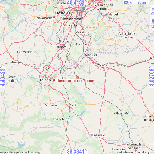
Villasequilla de Yepes GPS coordinates[2]
39° 52' 32.952" North, 3° 43' 51.96" West
| Map corner | latitude | longitude |
|---|---|---|
| Upper-left | 40.4133°, | -4.43423° |
| Center: | 39.87582°, | -3.7311° |
| Lower-right: | 39.3341°, | -3.02798° |
| Map W x H: | 120×120 km | = 74.6×74.6mi |
| max Lat: | 43.74134° ⇑72% North |
| Villasequilla de Yepes: | 39.87582° |
| min Lat: | ⇓28% South 27.64134° |
| min Long | Villasequilla d | max Long |
| -18.00367° | -3.7311° | 4.2899° |
| W 44.2%⇐ | ⇒55.8% E |
Elevation
Elevation of Villasequilla de Yepes is 519 m = 1703 ft, and this is 79 m = 259 ft below average elevation for this country.
| Max E: |
1682 m = 5518 ft | 60.6% |
| Avg. | 598 m = 1962 ft | |
| Villasequilla de Yepes | 519 m = 1703 ft | |
Min E: |
0 m = 0 ft | 39.4% |
See also: Spain elevation on elevation.city.
Geographical zone
Villasequilla de Yepes is located in North temperate zone (between Tropic of Cancer and the Arctic Circle). Distance of this Northern Tropic circle is 1827.9 km =1135.8 mi to South.| Distance of | km | miles | from Villasequilla de Yepes |
|---|---|---|---|
| North Pole | 5573.3 | 3463.1 | to North |
| Arctic Circle | 2967.4 | 1843.9 | to North |
| Tropic Cancer | 1827.9 | 1135.8 | to South |
| Equator | 4433.8 | 2755 | to South |


Nearby cities:
15 places around Villasequilla de Yepes: (largest is in red/bold)
• Almonacid de Toledo
17 km =10.6 mi,  217°
217°
• Añover de Tajo
12.9 km =8 mi,  346°
346°
• Cabañas de Yepes
16.8 km =10.4 mi,  84°
84°
• Ciruelos
12.2 km =7.6 mi,  54°
54°
• Cobeja
19.3 km =12 mi,  326°
326°
• Huerta de Valdecarábanos
10.2 km =6.3 mi,  97°
97°
• La Alameda de la Sagra
16 km =9.9 mi,  340°
340°
• Magán
19.6 km =12.2 mi,  299°
299°
• Mascaraque
19 km =11.8 mi,  201°
201°
• Mocejón
17.4 km =10.8 mi,  293°
293°
• Ontígola
19.7 km =12.2 mi,  43°
43°
• Villamuelas
6.5 km =4 mi,  182°
182°
• Villanueva de Bogas
18.1 km =11.2 mi,  159°
159°
• Villaseca de la Sagra
16.1 km =10 mi,  306°
306°
• Yepes
9.5 km =5.9 mi,  72°
72°
Sources, notices
• [Note1] Compared only with cities in Spain existing in our database
• [Src1] Map data: © OpenStreetMap contributors (CC-BY-SA)
• [Src2] Other city data from geonames.org with taken over terms of usage.
• [Src3] Geographical zone / Annual Mean Temperature by Robert A. Rohde @ Wikipedia
