Villaluenga del Rosario geodata
Villaluenga del Rosario (Andalusia) is a seat of a third-order administrative division; located in Spain in Europe/Madrid (GMT+2) time zone. With population of 495 people, there are 3903 cities with bigger population in this country. Compared to other cities in Spain, 97.5% of cities are located further ↑North; 77.2% of cities are located further →East and 76.9% of cities have lower elevation than Villaluenga del Rosario. Note1
Administrative division(s):
- Level 1: Andalusia
- Level 2: Provincia de Cádiz
- Level 3: Villaluenga del Rosario
Current local time in Villaluenga del Rosario:
10:46 PM, ThursdayDifference from your time zone: hours


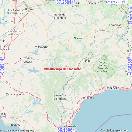
Villaluenga del Rosario GPS coordinates[2]
36° 41' 47.184" North, 5° 23' 9.636" West
| Map corner | latitude | longitude |
|---|---|---|
| Upper-left | 37.25814°, | -6.08914° |
| Center: | 36.69644°, | -5.38601° |
| Lower-right: | 36.1306°, | -4.68289° |
| Map W x H: | 125.4×125.4 km | = 77.9×77.9mi |
| max Lat: | 43.74134° ⇑97.5% North |
| Villaluenga del Rosario: | 36.69644° |
| min Lat: | ⇓2.5% South 27.64134° |
| min Long | Villaluenga del | max Long |
| -18.00367° | -5.38601° | 4.2899° |
| W 22.8%⇐ | ⇒77.2% E |
Elevation
Elevation of Villaluenga del Rosario is 870 m = 2854 ft, and this is 272 m = 892 ft above average elevation for this country.
| Max E: |
1682 m = 5518 ft | 23.1% |
| Villaluenga del Rosario | 870 m 2854 ft | |
| Avg. | 598 m = 1962 ft | |
Min E: |
0 m = 0 ft | 76.9% |
See also: Spain elevation on elevation.city.
Geographical zone
Villaluenga del Rosario is located in North temperate zone (between Tropic of Cancer and the Arctic Circle). Distance of this Northern Tropic circle is 1474.3 km =916.1 mi to South.| Distance of | km | miles | from Villaluenga del Rosario |
|---|---|---|---|
| North Pole | 5926.8 | 3682.7 | to North |
| Arctic Circle | 3320.9 | 2063.5 | to North |
| Tropic Cancer | 1474.3 | 916.1 | to South |
| Equator | 4080.3 | 2535.4 | to South |


Nearby cities:
15 places around Villaluenga del Rosario: (largest is in red/bold)
• Algatocín
16.8 km =10.4 mi,  144°
144°
• Alpandeire
17.8 km =11.1 mi,  112°
112°
• Atajate
14 km =8.7 mi,  116°
116°
• Benalauría
15.9 km =9.9 mi, 135°
• Benaocaz
3.3 km =2.1 mi,  278°
278°
• Benaoján
12.2 km =7.6 mi,  77°
77°
• Cortes de la Frontera
9.6 km =6 mi,  156°
156°
• El Bosque
12.7 km =7.9 mi,  302°
302°
• Grazalema
7.3 km =4.5 mi,  12°
12°
• Jimera de Líbar
11.2 km =7 mi, 116°
• Montecorto
15.4 km =9.6 mi,  30°
30°
• Montejaque
12.9 km =8 mi,  69°
69°
• Prado del Rey
18.2 km =11.3 mi, 303°
• Ubrique
5.7 km =3.5 mi,  248°
248°
• Zahara
16 km =9.9 mi,  358°
358°
Sources, notices
• [Note1] Compared only with cities in Spain existing in our database
• [Src1] Map data: © OpenStreetMap contributors (CC-BY-SA)
• [Src2] Other city data from geonames.org with taken over terms of usage.
• [Src3] Geographical zone / Annual Mean Temperature by Robert A. Rohde @ Wikipedia
