Montejaque geodata
Montejaque (Andalusia) is a seat of a third-order administrative division; located in Spain in Europe/Madrid (GMT+2) time zone. With population of 983 people, there are 2974 cities with bigger population in this country. Compared to other cities in Spain, 97.3% of cities are located further ↑North; 75.7% of cities are located further →East and 52% of cities have lower elevation than Montejaque. Note1


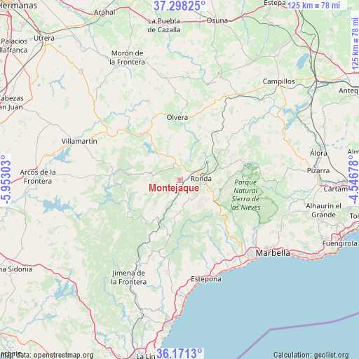
Montejaque GPS coordinates[2]
36° 44' 12.624" North, 5° 14' 59.64" West
| Map corner | latitude | longitude |
|---|---|---|
| Upper-left | 37.29825°, | -5.95303° |
| Center: | 36.73684°, | -5.2499° |
| Lower-right: | 36.1713°, | -4.54678° |
| Map W x H: | 125.3×125.3 km | = 77.9×77.9mi |
| max Lat: | 43.74134° ⇑97.3% North |
| Montejaque: | 36.73684° |
| min Lat: | ⇓2.7% South 27.64134° |
| min Long | Montejaque | max Long |
| -18.00367° | -5.2499° | 4.2899° |
| W 24.3%⇐ | ⇒75.7% E |
Elevation
Elevation of Montejaque is 679 m = 2228 ft, and this is 81 m = 266 ft above average elevation for this country.
| Max E: |
1682 m = 5518 ft | 48% |
| Montejaque | 679 m 2228 ft | |
| Avg. | 598 m = 1962 ft | |
Min E: |
0 m = 0 ft | 52% |
See also: Spain elevation on elevation.city.
Geographical zone
Montejaque is located in North temperate zone (between Tropic of Cancer and the Arctic Circle). Distance of this Northern Tropic circle is 1478.8 km =918.9 mi to South.| Distance of | km | miles | from Montejaque |
|---|---|---|---|
| North Pole | 5922.3 | 3679.9 | to North |
| Arctic Circle | 3316.4 | 2060.7 | to North |
| Tropic Cancer | 1478.8 | 918.9 | to South |
| Equator | 4084.8 | 2538.2 | to South |


Nearby cities:
15 places around Montejaque: (largest is in red/bold)
• Alpandeire
12.2 km =7.6 mi,  159°
159°
• Arriate
12 km =7.5 mi,  54°
54°
• Atajate
10.8 km =6.7 mi,  178°
178°
• Benaoján
2 km =1.2 mi,  185°
185°
• Cartajima
13.3 km =8.3 mi,  139°
139°
• El Gastor
14.7 km =9.1 mi,  333°
333°
• Faraján
14.4 km =8.9 mi, 157°
• Grazalema
10.9 km =6.8 mi,  283°
283°
• Jimera de Líbar
9.8 km =6.1 mi, 192°
• Júzcar
14.4 km =8.9 mi,  150°
150°
• Montecorto
9.8 km =6.1 mi, 333°
• Parauta
14 km =8.7 mi,  129°
129°
• Ronda
7.4 km =4.6 mi,  85°
85°
• Setenil de las Bodegas
15.4 km =9.6 mi,  23°
23°
• Villaluenga del Rosario
12.9 km =8 mi,  249°
249°
Sources, notices
• [Note1] Compared only with cities in Spain existing in our database
• [Src1] Map data: © OpenStreetMap contributors (CC-BY-SA)
• [Src2] Other city data from geonames.org with taken over terms of usage.
• [Src3] Geographical zone / Annual Mean Temperature by Robert A. Rohde @ Wikipedia
