Valdemanco del Esteras geodata
Valdemanco del Esteras (Castille-La Mancha) is a seat of a third-order administrative division; located in Spain in Europe/Madrid (GMT+2) time zone. In our database, there are 6762 cities with bigger population. Compared to other cities in Spain, 81.7% of cities are located further ↑North; 70% of cities are located further →East and 58.1% of cities have higher elevation than Valdemanco del Esteras. Note1
Administrative division(s):
- Level 1: Castille-La Mancha
- Level 2: Provincia de Ciudad Real
- Level 3: Valdemanco del Esteras
Current local time in Valdemanco del Esteras:
11:57 PM, ThursdayDifference from your time zone: hours


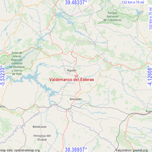
Valdemanco del Esteras GPS coordinates[2]
38° 56' 18.888" North, 4° 49' 45.12" West
| Map corner | latitude | longitude |
|---|---|---|
| Upper-left | 39.48337°, | -5.53233° |
| Center: | 38.93858°, | -4.8292° |
| Lower-right: | 38.38957°, | -4.12608° |
| Map W x H: | 121.6×121.6 km | = 75.6×75.6mi |
| max Lat: | 43.74134° ⇑81.7% North |
| Valdemanco del Esteras: | 38.93858° |
| min Lat: | ⇓18.3% South 27.64134° |
| min Long | Valdemanco del | max Long |
| -18.00367° | -4.8292° | 4.2899° |
| W 30%⇐ | ⇒70% E |
Elevation
Elevation of Valdemanco del Esteras is 551 m = 1808 ft, and this is 47 m = 154 ft below average elevation for this country.
| Max E: |
1682 m = 5518 ft | 58.1% |
| Avg. | 598 m = 1962 ft | |
| Valdemanco del Esteras | 551 m = 1808 ft | |
Min E: |
0 m = 0 ft | 41.9% |
See also: Spain elevation on elevation.city.
Geographical zone
Valdemanco del Esteras is located in North temperate zone (between Tropic of Cancer and the Arctic Circle). Distance of this Northern Tropic circle is 1723.6 km =1071 mi to South.| Distance of | km | miles | from Valdemanco del Esteras |
|---|---|---|---|
| North Pole | 5677.5 | 3527.8 | to North |
| Arctic Circle | 3071.6 | 1908.6 | to North |
| Tropic Cancer | 1723.6 | 1071 | to South |
| Equator | 4329.6 | 2690.3 | to South |


Nearby cities:
15 places around Valdemanco del Esteras: (largest is in red/bold)
• Agudo
6 km =3.7 mi,  322°
322°
• Alamillo
29.1 km =18.1 mi,  173°
173°
• Almadén
18.1 km =11.2 mi,  180°
180°
• Baterno
7.3 km =4.5 mi,  285°
285°
• Capilla
25.7 km =16 mi,  239°
239°
• Chillón
16.2 km =10.1 mi,  191°
191°
• Fuenlabrada de los Montes
23.5 km =14.6 mi,  337°
337°
• Garbayuela
19.1 km =11.9 mi,  310°
310°
• Garlitos
20 km =12.4 mi,  251°
251°
• Guadalmez
26.6 km =16.5 mi,  207°
207°
• Peñalsordo
27.9 km =17.3 mi, 241°
• Puebla de Don Rodrigo
24.4 km =15.2 mi,  47°
47°
• Saceruela
19.2 km =11.9 mi,  88°
88°
• Siruela
19.5 km =12.1 mi,  282°
282°
• Tamurejo
10.3 km =6.4 mi,  298°
298°
Sources, notices
• [Note1] Compared only with cities in Spain existing in our database
• [Src1] Map data: © OpenStreetMap contributors (CC-BY-SA)
• [Src2] Other city data from geonames.org with taken over terms of usage.
• [Src3] Geographical zone / Annual Mean Temperature by Robert A. Rohde @ Wikipedia
