Terrinches geodata
Terrinches (Castille-La Mancha) is a seat of a third-order administrative division; located in Spain in Europe/Madrid (GMT+2) time zone. With population of 1,031 people, there are 2895 cities with bigger population in this country. Compared to other cities in Spain, 85% of cities are located further ↑North; 56.9% of cities are located further ←West and 84.9% of cities have lower elevation than Terrinches. Note1
Administrative division(s):
- Level 1: Castille-La Mancha
- Level 2: Provincia de Ciudad Real
- Level 3: Terrinches


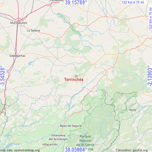
Terrinches GPS coordinates[2]
38° 36' 38.052" North, 2° 50' 31.74" West
| Map corner | latitude | longitude |
|---|---|---|
| Upper-left | 39.15789°, | -3.54528° |
| Center: | 38.61057°, | -2.84215° |
| Lower-right: | 38.05904°, | -2.13903° |
| Map W x H: | 122.2×122.2 km | = 75.9×75.9mi |
| max Lat: | 43.74134° ⇑85% North |
| Terrinches: | 38.61057° |
| min Lat: | ⇓15% South 27.64134° |
| min Long | Terrinches | max Long |
| -18.00367° | -2.84215° | 4.2899° |
| W 56.9%⇐ | ⇒43.1% E |
Elevation
Elevation of Terrinches is 949 m = 3114 ft, and this is 351 m = 1152 ft above average elevation for this country.
| Max E: |
1682 m = 5518 ft | 15.1% |
| Terrinches | 949 m 3114 ft | |
| Avg. | 598 m = 1962 ft | |
Min E: |
0 m = 0 ft | 84.9% |
See also: Spain elevation on elevation.city.
Geographical zone
Terrinches is located in North temperate zone (between Tropic of Cancer and the Arctic Circle). Distance of this Northern Tropic circle is 1687.2 km =1048.4 mi to South.| Distance of | km | miles | from Terrinches |
|---|---|---|---|
| North Pole | 5714 | 3550.5 | to North |
| Arctic Circle | 3108.1 | 1931.3 | to North |
| Tropic Cancer | 1687.2 | 1048.4 | to South |
| Equator | 4293.1 | 2667.6 | to South |


Nearby cities:
15 places around Terrinches: (largest is in red/bold)
• Albaladejo
3.1 km =1.9 mi,  72°
72°
• Almedina
9.8 km =6.1 mi,  279°
279°
• Bienservida
22.6 km =14 mi,  117°
117°
• Cózar
20.8 km =12.9 mi,  286°
286°
• Fuenllana
19 km =11.8 mi,  328°
328°
• Génave
22.1 km =13.7 mi,  154°
154°
• Infantes
20.4 km =12.7 mi,  313°
313°
• Montiel
9.9 km =6.2 mi,  348°
348°
• Puebla del Príncipe
8.7 km =5.4 mi,  236°
236°
• Santa Cruz de los Cáñamos
3.7 km =2.3 mi, 325°
• Torre de Juan Abad
19.2 km =11.9 mi,  261°
261°
• Villahermosa
15.7 km =9.8 mi, 350°
• Villamanrique
15.3 km =9.5 mi, 242°
• Villanueva de la Fuente
15.7 km =9.8 mi,  53°
53°
• Villapalacios
18.5 km =11.5 mi,  102°
102°
Sources, notices
• [Note1] Compared only with cities in Spain existing in our database
• [Src1] Map data: © OpenStreetMap contributors (CC-BY-SA)
• [Src2] Other city data from geonames.org with taken over terms of usage.
• [Src3] Geographical zone / Annual Mean Temperature by Robert A. Rohde @ Wikipedia
