Torre de Juan Abad geodata
Torre de Juan Abad (Castille-La Mancha) is a seat of a third-order administrative division; located in Spain in Europe/Madrid (GMT+2) time zone. With population of 1,332 people, there are 2611 cities with bigger population in this country. Compared to other cities in Spain, 85.1% of cities are located further ↑North; 53.4% of cities are located further ←West and 72.3% of cities have lower elevation than Torre de Juan Abad. Note1
Administrative division(s):
- Level 1: Castille-La Mancha
- Level 2: Provincia de Ciudad Real
- Level 3: Torre de Juan Abad


Torre de Juan Abad GPS coordinates[2]
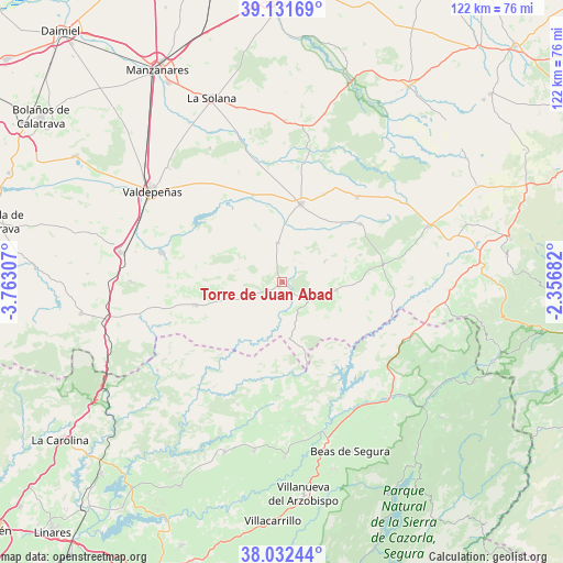
38° 35' 3.012" North, 3° 3' 35.784" West
| Map corner | latitude | longitude |
|---|---|---|
| Upper-left | 39.13169°, | -3.76307° |
| Center: | 38.58417°, | -3.05994° |
| Lower-right: | 38.03244°, | -2.35682° |
| Map W x H: | 122.2×122.2 km | = 75.9×75.9mi |
| max Lat: | 43.74134° ⇑85.1% North |
| Torre de Juan Abad: | 38.58417° |
| min Lat: | ⇓14.9% South 27.64134° |
| min Long | Torre de Juan A | max Long |
| -18.00367° | -3.05994° | 4.2899° |
| W 53.4%⇐ | ⇒46.6% E |
Elevation
Elevation of Torre de Juan Abad is 829 m = 2720 ft, and this is 231 m = 758 ft above average elevation for this country.
| Max E: |
1682 m = 5518 ft | 27.7% |
| Torre de Juan Abad | 829 m 2720 ft | |
| Avg. | 598 m = 1962 ft | |
Min E: |
0 m = 0 ft | 72.3% |
See also: Spain elevation on elevation.city.
Geographical zone
Torre de Juan Abad is located in North temperate zone (between Tropic of Cancer and the Arctic Circle). Distance of this Northern Tropic circle is 1684.2 km =1046.5 mi to South.| Distance of | km | miles | from Torre de Juan Abad |
|---|---|---|---|
| North Pole | 5716.9 | 3552.3 | to North |
| Arctic Circle | 3111 | 1933.1 | to North |
| Tropic Cancer | 1684.2 | 1046.5 | to South |
| Equator | 4290.2 | 2665.8 | to South |


Nearby cities:
15 places around Torre de Juan Abad: (largest is in red/bold)
• Albaladejo
22.2 km =13.8 mi,  80°
80°
• Alcubillas
19.9 km =12.4 mi,  341°
341°
• Almedina
10.3 km =6.4 mi,  64°
64°
• Castellar de Santiago
19.4 km =12.1 mi,  255°
255°
• Cózar
8.7 km =5.4 mi,  353°
353°
• Fuenllana
21 km =13 mi,  24°
24°
• Infantes
17.5 km =10.9 mi,  13°
13°
• Montiel
21.2 km =13.2 mi,  53°
53°
• Montizón
27.1 km =16.8 mi,  188°
188°
• Puebla del Príncipe
11.8 km =7.3 mi,  98°
98°
• Santa Cruz de los Cáñamos
17.9 km =11.1 mi,  70°
70°
• Terrinches
19.2 km =11.9 mi, 81°
• Torrenueva
27 km =16.8 mi,  283°
283°
• Villahermosa
24.7 km =15.3 mi,  41°
41°
• Villamanrique
6.9 km =4.3 mi,  127°
127°
Sources, notices
• [Note1] Compared only with cities in Spain existing in our database
• [Src1] Map data: © OpenStreetMap contributors (CC-BY-SA)
• [Src2] Other city data from geonames.org with taken over terms of usage.
• [Src3] Geographical zone / Annual Mean Temperature by Robert A. Rohde @ Wikipedia
