Villamanrique geodata
Villamanrique (Castille-La Mancha) is a seat of a third-order administrative division; located in Spain in Europe/Madrid (GMT+2) time zone. With population of 1,506 people, there are 2456 cities with bigger population in this country. Compared to other cities in Spain, 85.3% of cities are located further ↑North; 54.5% of cities are located further ←West and 75.4% of cities have lower elevation than Villamanrique. Note1
Administrative division(s):
- Level 1: Castille-La Mancha
- Level 2: Provincia de Ciudad Real
- Level 3: Villamanrique


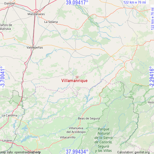
Villamanrique GPS coordinates[2]
38° 32' 46.896" North, 2° 59' 50.244" West
| Map corner | latitude | longitude |
|---|---|---|
| Upper-left | 39.09417°, | -3.70041° |
| Center: | 38.54636°, | -2.99729° |
| Lower-right: | 37.99434°, | -2.29416° |
| Map W x H: | 122.3×122.3 km | = 76×76mi |
| max Lat: | 43.74134° ⇑85.3% North |
| Villamanrique: | 38.54636° |
| min Lat: | ⇓14.7% South 27.64134° |
| min Long | Villamanrique | max Long |
| -18.00367° | -2.99729° | 4.2899° |
| W 54.5%⇐ | ⇒45.5% E |
Elevation
Elevation of Villamanrique is 855 m = 2805 ft, and this is 257 m = 843 ft above average elevation for this country.
| Max E: |
1682 m = 5518 ft | 24.6% |
| Villamanrique | 855 m 2805 ft | |
| Avg. | 598 m = 1962 ft | |
Min E: |
0 m = 0 ft | 75.4% |
See also: Spain elevation on elevation.city.
Geographical zone
Villamanrique is located in North temperate zone (between Tropic of Cancer and the Arctic Circle). Distance of this Northern Tropic circle is 1680 km =1043.9 mi to South.| Distance of | km | miles | from Villamanrique |
|---|---|---|---|
| North Pole | 5721.1 | 3554.9 | to North |
| Arctic Circle | 3115.2 | 1935.7 | to North |
| Tropic Cancer | 1680 | 1043.9 | to South |
| Equator | 4286 | 2663.2 | to South |


Nearby cities:
15 places around Villamanrique: (largest is in red/bold)
• Albaladejo
18.3 km =11.4 mi,  63°
63°
• Alcubillas
25.9 km =16.1 mi,  332°
332°
• Almedina
9.5 km =5.9 mi,  23°
23°
• Castellar de Santiago
24.2 km =15 mi,  268°
268°
• Cózar
14.4 km =8.9 mi, 333°
• Fuenllana
23.5 km =14.6 mi,  8°
8°
• Génave
26.3 km =16.3 mi,  119°
119°
• Infantes
21.2 km =13.2 mi,  356°
356°
• Montiel
20.4 km =12.7 mi,  34°
34°
• Montizón
24.5 km =15.2 mi,  202°
202°
• Puebla del Príncipe
6.6 km =4.1 mi,  69°
69°
• Santa Cruz de los Cáñamos
15.3 km =9.5 mi,  48°
48°
• Terrinches
15.3 km =9.5 mi, 62°
• Torre de Juan Abad
6.9 km =4.3 mi,  307°
307°
• Villahermosa
25.2 km =15.7 mi, 25°
Sources, notices
• [Note1] Compared only with cities in Spain existing in our database
• [Src1] Map data: © OpenStreetMap contributors (CC-BY-SA)
• [Src2] Other city data from geonames.org with taken over terms of usage.
• [Src3] Geographical zone / Annual Mean Temperature by Robert A. Rohde @ Wikipedia
