Santa Pola geodata
Santa Pola (Valencia) is a seat of a third-order administrative division; located in Spain in Europe/Madrid (GMT+2) time zone. With population of 31,760 people, there are 281 cities with bigger population in this country. Compared to other cities in Spain, 87.2% of cities are located further ↑North; 81% of cities are located further ←West and 99.2% of cities have higher elevation than Santa Pola. Note1


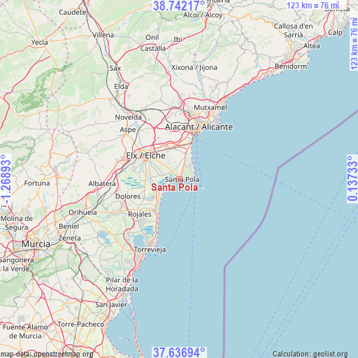
Santa Pola GPS coordinates[2]
38° 11' 29.94" North, 0° 33' 56.88" West
| Map corner | latitude | longitude |
|---|---|---|
| Upper-left | 38.74217°, | -1.26893° |
| Center: | 38.19165°, | -0.5658° |
| Lower-right: | 37.63694°, | 0.13733° |
| Map W x H: | 122.9×122.9 km | = 76.4×76.4mi |
| max Lat: | 43.74134° ⇑87.2% North |
| Santa Pola: | 38.19165° |
| min Lat: | ⇓12.8% South 27.64134° |
| min Long | Santa Pola | max Long |
| -18.00367° | -0.5658° | 4.2899° |
| W 81%⇐ | ⇒19% E |
Elevation
Elevation of Santa Pola is 7 m = 23 ft, and this is 591 m = 1939 ft below average elevation for this country.
| Max E: |
1682 m = 5518 ft | 99.2% |
| Avg. | 598 m = 1962 ft | |
| Santa Pola | 7 m = 23 ft | |
Min E: |
0 m = 0 ft | 0.8% |
See also: Spain elevation on elevation.city.
Geographical zone
Santa Pola is located in North temperate zone (between Tropic of Cancer and the Arctic Circle). Distance of this Northern Tropic circle is 1640.6 km =1019.4 mi to South.| Distance of | km | miles | from Santa Pola |
|---|---|---|---|
| North Pole | 5760.5 | 3579.4 | to North |
| Arctic Circle | 3154.7 | 1960.2 | to North |
| Tropic Cancer | 1640.6 | 1019.4 | to South |
| Equator | 4246.5 | 2638.7 | to South |


Nearby cities:
15 places around Santa Pola: (largest is in red/bold)
• Algorfa
23.3 km =14.5 mi,  239°
239°
• Alicante
18.6 km =11.6 mi,  23°
23°
• Almoradí
21.8 km =13.5 mi,  245°
245°
• Benijofar
19.6 km =12.2 mi,  229°
229°
• Catral
20.9 km =13 mi,  260°
260°
• Crevillente
22.3 km =13.9 mi,  286°
286°
• Daya Nueva
19.1 km =11.9 mi, 242°
• Daya Vieja
17.9 km =11.1 mi, 237°
• Dolores
18.8 km =11.7 mi, 252°
• Elche
14.2 km =8.8 mi,  303°
303°
• Formentera de Segura
19.7 km =12.2 mi, 233°
• Guardamar del Segura
13.7 km =8.5 mi,  214°
214°
• Los Montesinos
24 km =14.9 mi,  220°
220°
• Rojales
18.1 km =11.2 mi, 230°
• San Vicent del Raspeig
23 km =14.3 mi,  8°
8°
Sources, notices
• [Note1] Compared only with cities in Spain existing in our database
• [Src1] Map data: © OpenStreetMap contributors (CC-BY-SA)
• [Src2] Other city data from geonames.org with taken over terms of usage.
• [Src3] Geographical zone / Annual Mean Temperature by Robert A. Rohde @ Wikipedia
