Santaella geodata
Santaella (Andalusia) is a seat of a third-order administrative division; located in Spain in Europe/Madrid (GMT+2) time zone. With population of 5,933 people, there are 1147 cities with bigger population in this country. Compared to other cities in Spain, 91% of cities are located further ↑North; 70.3% of cities are located further →East and 77.7% of cities have higher elevation than Santaella. Note1


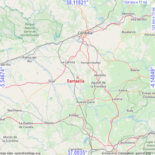
Santaella GPS coordinates[2]
37° 33' 46.584" North, 4° 50' 37.032" West
| Map corner | latitude | longitude |
|---|---|---|
| Upper-left | 38.11821°, | -5.54674° |
| Center: | 37.56294°, | -4.84362° |
| Lower-right: | 37.0035°, | -4.14049° |
| Map W x H: | 123.9×123.9 km | = 77×77mi |
| max Lat: | 43.74134° ⇑91% North |
| Santaella: | 37.56294° |
| min Lat: | ⇓9% South 27.64134° |
| min Long | Santaella | max Long |
| -18.00367° | -4.84362° | 4.2899° |
| W 29.7%⇐ | ⇒70.3% E |
Elevation
Elevation of Santaella is 260 m = 853 ft, and this is 338 m = 1109 ft below average elevation for this country.
| Max E: |
1682 m = 5518 ft | 77.7% |
| Avg. | 598 m = 1962 ft | |
| Santaella | 260 m = 853 ft | |
Min E: |
0 m = 0 ft | 22.3% |
See also: Spain elevation on elevation.city.
Geographical zone
Santaella is located in North temperate zone (between Tropic of Cancer and the Arctic Circle). Distance of this Northern Tropic circle is 1570.7 km =976 mi to South.| Distance of | km | miles | from Santaella |
|---|---|---|---|
| North Pole | 5830.5 | 3622.9 | to North |
| Arctic Circle | 3224.6 | 2003.7 | to North |
| Tropic Cancer | 1570.7 | 976 | to South |
| Equator | 4176.6 | 2595.2 | to South |


Nearby cities:
15 places around Santaella: (largest is in red/bold)
• Aguilar
17.3 km =10.7 mi,  108°
108°
• Fernán-Núñez
15.8 km =9.8 mi,  40°
40°
• Guadalcázar
23.4 km =14.5 mi,  337°
337°
• Herrera
22.1 km =13.7 mi,  181°
181°
• La Carlota
14.5 km =9 mi,  327°
327°
• La Rambla
10.4 km =6.5 mi,  61°
61°
• La Victoria
13.2 km =8.2 mi,  356°
356°
• Marinaleda
23.6 km =14.7 mi,  205°
205°
• Montalbán de Córdoba
8.5 km =5.3 mi,  77°
77°
• Montemayor
15.9 km =9.9 mi,  53°
53°
• Montilla
18.3 km =11.4 mi, 81°
• Moriles
25.1 km =15.6 mi,  123°
123°
• Puente-Genil
20.4 km =12.7 mi,  160°
160°
• San Sebastián de los Ballesteros
10.2 km =6.3 mi,  9°
9°
• Écija
21.2 km =13.2 mi,  263°
263°
Sources, notices
• [Note1] Compared only with cities in Spain existing in our database
• [Src1] Map data: © OpenStreetMap contributors (CC-BY-SA)
• [Src2] Other city data from geonames.org with taken over terms of usage.
• [Src3] Geographical zone / Annual Mean Temperature by Robert A. Rohde @ Wikipedia
